Difference between revisions of "2009-03-16 34 -84"
(New page: {{meetup graticule | map=<map lat="34" lon="-84" date="2009-03-16" /> | lat=34 | lon=-84 | date=2009-03-16 | graticule_name=Talking Rock | graticule_link=Talking Rock, Georgia }} == Grati...) |
imported>Benjw m (typos + meetup category not needed as the map template does it for you) |
||
| Line 19: | Line 19: | ||
==Expeditions== | ==Expeditions== | ||
| − | After checking on this geohash in the Atlanta Graticule and being way | + | After checking on this geohash in the Atlanta Graticule and being way too far south to be able to do at lunch time. I decided to check on where the hash point is in this graticule. As it turns out, this hash point is about a mile out of my way when I take back roads home and don't travel top end I-285. |
Today it was raining all day and before I left work, I checked www.georgia-navigator.com to see what I-285 east bound was looking like. The map said that it was slow but moving. So I decided to skip the GeoHashing for today. Just as I was about to get on the on ramp to I-75 south bound, I heard on the radio that there has been a 3 car pile up on I-285 east bound with 3 of the 4 lanes blocked. The estimate on the radio from I-75 going east on I-285 to I-85(the route I was taking) would take an hour. | Today it was raining all day and before I left work, I checked www.georgia-navigator.com to see what I-285 east bound was looking like. The map said that it was slow but moving. So I decided to skip the GeoHashing for today. Just as I was about to get on the on ramp to I-75 south bound, I heard on the radio that there has been a 3 car pile up on I-285 east bound with 3 of the 4 lanes blocked. The estimate on the radio from I-75 going east on I-285 to I-85(the route I was taking) would take an hour. | ||
| Line 37: | Line 37: | ||
Image:20090316_34_-84NW03.JPG| | Image:20090316_34_-84NW03.JPG| | ||
Image:20090316_34_-84NW04.JPG| | Image:20090316_34_-84NW04.JPG| | ||
| − | </gallery | + | </gallery> |
[[Category:Expeditions]] | [[Category:Expeditions]] | ||
[[Category:Expedition without GPS]] | [[Category:Expedition without GPS]] | ||
[[Category:Coordinates reached]] | [[Category:Coordinates reached]] | ||
| − | |||
Revision as of 14:03, 17 March 2009
| Mon 16 Mar 2009 in Talking Rock: 34.0560663, -84.3573496 geohashing.info google osm bing/os kml crox |
Contents
Graticule
People
- NWoodruff attempted and arrived about 5:50pm.
Expeditions
After checking on this geohash in the Atlanta Graticule and being way too far south to be able to do at lunch time. I decided to check on where the hash point is in this graticule. As it turns out, this hash point is about a mile out of my way when I take back roads home and don't travel top end I-285.
Today it was raining all day and before I left work, I checked www.georgia-navigator.com to see what I-285 east bound was looking like. The map said that it was slow but moving. So I decided to skip the GeoHashing for today. Just as I was about to get on the on ramp to I-75 south bound, I heard on the radio that there has been a 3 car pile up on I-285 east bound with 3 of the 4 lanes blocked. The estimate on the radio from I-75 going east on I-285 to I-85(the route I was taking) would take an hour.
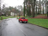
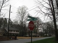
Okay... So I am Geohashing today. I didn't get on I-75 south bound and continued on back roads. The hash was easy to find since it was only less than a mile out of my way.
The hash point appears to be inside the house. There was a car in the driveway. I walked up to the door and knocked, several times. Nobody answered. I could hear music playing that sounded like it was coming from inside the house. I could not tell if someone was home or they had just left the radio on.
I decided that with the possibility of someone being home that I shouldn't go snooping around their back yard with out their permission to get closer to the hash point.
Knocking on the door does get me within the required 10 meters. So I will accept the Land Geohash for today and will declare that the coordinates reached.
Gallery
- Photo Gallery


