Difference between revisions of "2009-04-13 49 9"
From Geohashing
imported>Ekorren (template only yet, report follows) |
imported>Ekorren (Gallery) |
||
| Line 19: | Line 19: | ||
<gallery> | <gallery> | ||
| + | Image:2009-04-13 49 9 Start.jpg|Early start | ||
| + | Image:2009-04-13 49 9 Oppenweiler.jpg|Castle Oppenweiler as seen from the train | ||
| + | Image:2009-04-13 49 9 Gaildorf.jpg|From here by bike | ||
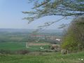
| + | Image:2009-04-13 49 9 Peak.jpg|First peak reached - a view back into the valley | ||
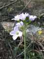
| + | Image:2009-04-13 49 9 Flower.jpg|It's finally getting spring | ||
| + | Image:2009-04-13 49 9 Oberfischach.jpg|Oberfischach | ||
| + | Image:2009-04-13 49 9 Herlebach.jpg|Hash village reached | ||
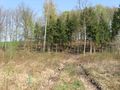
| + | Image:2009-04-13 49 9 Wood.jpg|Near hash | ||
| + | Image:2009-04-13 49 9 Hashpoint.jpg|The hashpoint | ||
| + | Image:2009-04-13 49 9 HashFlower.jpg|Hash Flower | ||
| + | Image:2009-04-13 49 9 Einkorn.jpg|View from the Einkorn | ||
| + | Image:2009-04-13 49 9 Rosensteinpark.jpg|Happy Easter at Stuttgart! | ||
| + | Image:2009-04-13 49 9 GPS.jpg|As always, whatever. | ||
</gallery> | </gallery> | ||
Revision as of 16:14, 14 April 2009
| Mon 13 Apr 2009 in Würzburg: 49.0737580, 9.8411838 geohashing.info google osm bing/os kml crox |
Location
A forest near the little village Herlebach. about 10 km from Schwäbisch Hall.
Expedition by Ekorren
tbd
Gallery
tbd
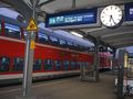
Early start
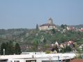
Castle Oppenweiler as seen from the train
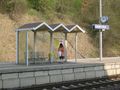
From here by bike
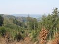
First peak reached - a view back into the valley
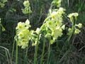
It's finally getting spring
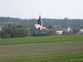
Oberfischach
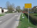
Hash village reached
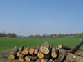
Near hash
The hashpoint
Hash Flower
View from the Einkorn

Happy Easter at Stuttgart!
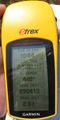
As always, whatever.


