Difference between revisions of "2009-04-18 -37 174"
From Geohashing
imported>TunezNZ (Report) |
imported>TunezNZ m |
||
| Line 40: | Line 40: | ||
[[Category:Expeditions with photos]] | [[Category:Expeditions with photos]] | ||
[[Category:Coordinates reached]] | [[Category:Coordinates reached]] | ||
| − | |||
Revision as of 10:54, 18 April 2009
| Sat 18 Apr 2009 in -37,174: -37.0845888, 174.8377370 geohashing.info google osm bing/os kml crox |
Going on this one, will try make it for the 4pm meetup, I assume there wont be anyone else there, will also pick up 3 nearby caches, GC17F69, GC1AX9C and GC1K477.
Expedition
Left at about 2pm with the plan of going down to Karaka grabbing 3 of the local hash's in the area nearby, I got one, and tried the second although time was getting tight to get to the hash I decided to flag that one. got to the hash at 3.40pm, found the location, sat and waited until 4PM then shot off to the last cache of the day and then home.
Statistics
- Total Time 3 hours
- 85.2Km total distance
- Top speed 150km/h
- Average speed 42.6km/h
- attempted 3 caches
- 2 Successful
Location
Dirt road, nice clear grass verge, big hedge to one side, open paddock's to the other.
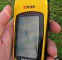
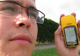
Photo's
Ribbons
TunezNZ earned the Land geohash achievement
|


