Difference between revisions of "2009-05-30 49 -118"
From Geohashing
imported>Juventas (new exp) |
imported>Juventas (some more bits) |
||
| Line 21: | Line 21: | ||
==Expedition== | ==Expedition== | ||
===The Hike=== | ===The Hike=== | ||
| − | |||
===Edgewood=== | ===Edgewood=== | ||
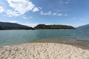
| + | [[image:2009-05-30_edgewood_campground.jpg|thumb]] | ||
| + | ===Needles=== | ||
| + | ===Highway 6=== | ||
| − | |||
[[Category:Expeditions]] | [[Category:Expeditions]] | ||
[[Category:Expeditions with photos]] | [[Category:Expeditions with photos]] | ||
[[Category:Coordinates reached]] | [[Category:Coordinates reached]] | ||
Revision as of 09:33, 2 June 2009
| Sat 30 May 2009 in Grand Forks, British Columbia: 49.7907899, -118.1342739 geohashing.info google osm bing/os kml crox |
Contents
Location
Near Edgewood.
Participants
Planning
Drive to Edgewood. Pull over just before town. Hike the steep incline. Success!
