Difference between revisions of "2009-07-23 37 -121"
From Geohashing
imported>Elness |
imported>Joannac m (typo) |
||
| Line 21: | Line 21: | ||
== Achievements == | == Achievements == | ||
| − | {{land geohash | latitude = 37 | longitude = -121 | date = 2009-07- | + | {{land geohash | latitude = 37 | longitude = -121 | date = 2009-07-23 | name = [[User:elness|elness]] }} |
[[Category:Expeditions]] | [[Category:Expeditions]] | ||
<!--[[Category:Expeditions with photos]] commented out pending photos--> | <!--[[Category:Expeditions with photos]] commented out pending photos--> | ||
[[Category:Coordinates reached]] | [[Category:Coordinates reached]] | ||
Revision as of 01:13, 27 July 2009
| Thu 23 Jul 2009 in 37,-121: 37.6954191, -121.0956819 geohashing.info google osm bing/os kml crox |
Contents
Location
Just inside an orchard on Toomes Road near Bacon Road, southwest of Salida.
People
The Tale
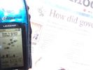
This one was reasonably close to my route home from work. I parked nearby on the side of the road just after 4 PM and found the hash coordinates to be just inside an almond orchard.
elness at the hashpoint in the almond orchard.
Achievements
elness earned the Land geohash achievement
|

