Difference between revisions of "2009-07-30 34 -84"
From Geohashing
imported>NWoodruff (→Gallery) |
imported>NWoodruff m (→Gallery) |
||
| Line 37: | Line 37: | ||
Image:20090730_34_-84NW11.JPG| A picture of the lake from the hash point. | Image:20090730_34_-84NW11.JPG| A picture of the lake from the hash point. | ||
Image:20090730_34_-84NW12.JPG| Me wading back to the shore. The water got almost knee deep. | Image:20090730_34_-84NW12.JPG| Me wading back to the shore. The water got almost knee deep. | ||
| − | Image:20090730_34_-84NW13.JPG| | + | Image:20090730_34_-84NW13.JPG| A picture of the actual hash spot. |
Image:20090730_34_-84NW14.JPG| | Image:20090730_34_-84NW14.JPG| | ||
</gallery> | </gallery> | ||
Revision as of 20:33, 31 July 2009
| Thu 30 Jul 2009 in Roswell: 34.1572655, -84.6975680 geohashing.info google osm bing/os kml crox |
Graticule
About
People
Expeditions
Gallery
- Photo Gallery
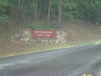
This hash point is in a beautiful state park.

There is a walking trail that goes in the direction of the hash point. 0.2 of a mile to go.

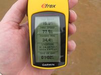
Wading to the now island. 21.3 feet to go.

2.06 feet to go. Close enough.
Time of the meetup.
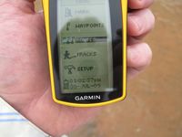
Date of the meetup.
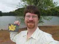
Me standing on the hash spot with a Stupid Grin™
If you zoom in to 100% of the picture, the white spot is actually my socks and shoes on the far waters edge.

Me taking some time to enjoy some lunch and the cool water on this 90F degree day.

Me sitting on the rocks enjoying some "Captain's Wafers™" crackers.
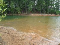
A picture of the lake from the hash point.

Me wading back to the shore. The water got almost knee deep.

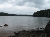
A picture of the actual hash spot.


Achievements
NWoodruff earned the Land geohash achievement
|