Difference between revisions of "2009-08-06 48 8"
From Geohashing
imported>Ekorren (template only yet, report follows) |
imported>Ekorren (Gallery up, report will follow.) |
||
| Line 16: | Line 16: | ||
== Gallery == | == Gallery == | ||
| + | |||
| + | <gallery> | ||
| + | Image:2009-08-06_48_8_Bridge.jpg|Cross this bridge | ||
| + | Image:2009-08-06_48_8_Trees.jpg|Way to hash | ||
| + | Image:2009-08-06_48_8_Flower.jpg|Flora near hashpoint | ||
| + | Image:2009-08-06_48_8_GPS.jpg|Coordinates reached (for a sufficient value of "reached") | ||
| + | Image:2009-08-06_48_8_Hashfield.jpg|The hash | ||
| + | Image:2009-08-06_48_8_Grain.jpg|Closeup | ||
| + | Image:2009-08-06_48_8_Sky.jpg|View in opposite direction | ||
| + | Image:2009-08-06_48_8_Autobahnbruecke.jpg|Don't cross this bridge | ||
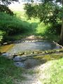
| + | Image:2009-08-06_48_8_Ford.jpg|Cross this... oh, there is no bridge. Only an old ford. | ||
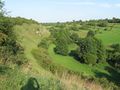
| + | Image:2009-08-06_48_8_Kochhartgraben.jpg|A beautiful valley | ||
| + | </gallery> | ||
[[Category:Expeditions]] | [[Category:Expeditions]] | ||
[[Category:Coordinates reached]] | [[Category:Coordinates reached]] | ||
[[Category:Expeditions with photos]] | [[Category:Expeditions with photos]] | ||
Revision as of 21:24, 6 August 2009
| Thu 6 Aug 2009 in 48,8: 48.5310632, 8.8530283 geohashing.info google osm bing/os kml crox |
Contents
Location
Between Bondorf and Hailfingen, at the edge of two fields. No way leading there, but one of the fields was already harvested.
Participants
Expedition
Gallery
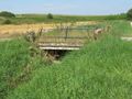
Cross this bridge
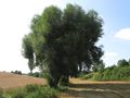
Way to hash
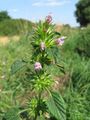
Flora near hashpoint
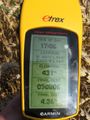
Coordinates reached (for a sufficient value of "reached")
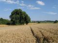
The hash
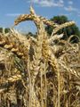
Closeup
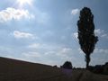
View in opposite direction
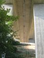
Don't cross this bridge
Cross this... oh, there is no bridge. Only an old ford.
A beautiful valley


