Difference between revisions of "2009-08-19 33 -84"
(→About) |
imported>NWoodruff (→Gallery) |
||
| Line 41: | Line 41: | ||
<gallery caption="Photo Gallery" widths="200px" heights="200px" perrow="3"> | <gallery caption="Photo Gallery" widths="200px" heights="200px" perrow="3"> | ||
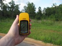
| − | Image:2009081933-84NW01.JPG| | + | Image:2009081933-84NW01.JPG| 0.39 miles to go. I can make it. |
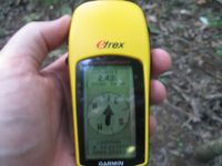
| + | Image:2009081933-84NW02.JPG| 2.43 feet to go. Close enough. | ||
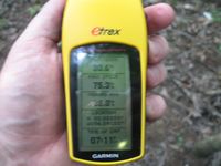
| + | Image:2009081933-84NW03.JPG| Time of the meetup. | ||
| + | Image:2009081933-84NW04.JPG| Me with a Stupid Grin™ | ||
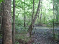
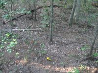
| + | Image:2009081933-84NW05.JPG| Picture from the hash point looking North. | ||
| + | Image:2009081933-84NW06.JPG| Picture from the hash point looking South. | ||
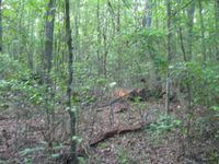
| + | Image:2009081933-84NW07.JPG| Picture of the actual Geohash point. | ||
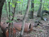
| + | Image:2009081933-84NW08.JPG| The remaining parts of what looks like an old Whiskey still. Yeeee... Haaaawwww! | ||
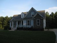
| + | Image:2009081933-84NW09.JPG| The picture of the house that is empty and in the middle of NOWHERE!! [http://www.mapquest.com/mq/6-L50d] | ||
| + | Image:2009081933-84NW10.JPG| The house is for sale. | ||
</gallery> | </gallery> | ||
Revision as of 12:25, 20 August 2009
| Wed 19 Aug 2009 in Atlanta: 33.3315018, -84.3915237 geohashing.info google osm bing/os kml crox |
Graticule
About
I ended up going somewhere.
Expedition
NWoodruff
I was very confused about this one as in Yesterday Tuesday Aug 18th, I get a set of coordinates early in the morning. I set out planing all day on planing a route. I set my eTrex up with directions. Just before I leave work for the Hash point, I print a map of where the hash point it and it is in a totally different place. I have the peeron map still up with the hash point that I was going to. Something wasn't right. I hit refresh and then peeron map jumps to a new place. What the?????
The hash point is in the exact opposite direction that I made plans to go. I couldn't make it to the hash point.
Today, I was very skeptical about today's hash point. I kept hitting refresh all day long. It didn't change. So I set off.
It was a drive to Fayetteville out to the middle of nowhere. The closest road access to the hash point has a complete house almost a mile from anything else, just sitting there. Seems very strange to me.
I got out of my truck and looked at my eTrex. 0.39 miles to go. As I started through the woods, the bugs were every where. I was slapping at mosquitoes constantly as I made my way to the hash point.
I ran across a few deer and other animals that scurried out of the way. I found the hash point with 2.43 feet to go.
The hash point was at an old place where a still had been set up to brew moonshine. Yeeee.... Haaawwwww! I took a few pictures and made a dash back to my truck to evade the army of mosquitoes that were now tracking me down.
I went over to investigate the house in the middle of nowhere. I noticed that none of the doors were locked but someone had put a piece of wire in each of the doors to be able to tell if someone had opened the doors. The strange thing to me is driving away from where I parked it was several miles until I came across someone, and they were just driving on the other side of the road.
I was half thinking that if someone was going to dump a body, going out to that hash point would probably be the perfect place because I doubt that any one had been there since the middle 1970's.
Gallery
- Photo Gallery
The picture of the house that is empty and in the middle of NOWHERE!! [1]
Achievements
NWoodruff earned the Land geohash achievement
|
