Difference between revisions of "2009-08-28 52 -0"
From Geohashing
imported>Joehardflec (→Location) |
imported>FippeBot m (Location) |
||
| (2 intermediate revisions by one other user not shown) | |||
| Line 15: | Line 15: | ||
== Participants == | == Participants == | ||
| − | + | [[User:Joehardflec|Joe Hardman]] | |
| − | |||
| − | |||
| − | |||
== Expedition == | == Expedition == | ||
| − | + | I went just after noon, parking at the B6047 end of the footpath section, waiting out a small rainshower, and then walking down the Gartree to the hashpoint. | |
| − | + | Luckily, the field was just stubble, so I managed to reach the exact point. | |
| − | |||
| − | |||
== Photos == | == Photos == | ||
| − | |||
| − | |||
| − | |||
| − | |||
| − | |||
<gallery perrow="3"> | <gallery perrow="3"> | ||
| − | + | Image:2009-08-28 52 -0 GPS.jpg | The GPS | |
| + | Image:2009-08-28 52 -0 Me.jpg | Me | ||
| + | Image:2009-08-28 52 -0 View1.jpg | View1 | ||
| + | Image:2009-08-28 52 -0 View2.jpg | View2 | ||
</gallery> | </gallery> | ||
| − | |||
| − | |||
| − | |||
| − | |||
| − | |||
| − | |||
| − | |||
[[Category:Expeditions]] | [[Category:Expeditions]] | ||
| − | |||
[[Category:Expeditions with photos]] | [[Category:Expeditions with photos]] | ||
| − | |||
| − | |||
| − | |||
| − | |||
| − | |||
[[Category:Coordinates reached]] | [[Category:Coordinates reached]] | ||
| − | + | {{location|GB|ENG|LEC}} | |
| − | |||
| − | |||
| − | |||
| − | |||
| − | |||
| − | |||
| − | |||
| − | |||
| − | |||
Latest revision as of 05:26, 8 August 2019
| Fri 28 Aug 2009 in 52,-0: 52.5643503, -0.9348701 geohashing.info google osm bing/os kml crox |
Location
Just off the Gartree Road (a section that's footpath/bridleway rather than road), near Shangton.
Participants
Expedition
I went just after noon, parking at the B6047 end of the footpath section, waiting out a small rainshower, and then walking down the Gartree to the hashpoint. Luckily, the field was just stubble, so I managed to reach the exact point.
Photos
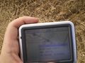
The GPS

Me
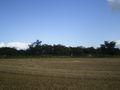
View1
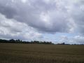
View2


