Difference between revisions of "2009-09-02 33 -84"
(New page: {{meetup graticule | map=<map lat="33" lon="-84" date="2009-09-02" /> | lat=33 | lon=-84 | date=2009-09-02 | graticule_name=Atlanta | graticule_link=Atlanta, Georgia }} == Graticule == ...) |
imported>FippeBot m (Location) |
||
| (3 intermediate revisions by one other user not shown) | |||
| Line 20: | Line 20: | ||
=== [[User:NWoodruff|NWoodruff]] === | === [[User:NWoodruff|NWoodruff]] === | ||
| + | Looking at the Google map, it appears that there is a long dirt road leading to close to the hash point. I drove up to the dirt road and as I turned on it, it was clear that it is a driveway. There is now a gate with a fence. There is enough room for my truck to be on the dirt drive way and off the road in front of the gate. I hopped out of my truck and started taking pictures of the gate and the no trespassing signs. | ||
| + | |||
| + | I got my eTrex out of the truck and made it back to the gate to get a picture of the closest point. As I was standing at the gate about to take a picture, a woman comes out of the house about 100 feet away and questions what I am doing. | ||
| + | |||
| + | I explain a little about Geohashing, I show her the Google map with the dirt road and the picture of her house, explain how the point is calculated and how lucky she is to get a hash point on her property and why I want to go to that spot. To her it seemed like she had won the lottery. | ||
| + | |||
| + | She said that it was okay for me to find the spot and she wanted to go with me. The dirt road now is very over grown but I found the closest point from the dirt road to the actual geohash point. The direct path to the hash point from the road is very thick brush. The woman followed me in for about 100 feet but there was another 300 feet to go. | ||
| + | |||
| + | I found my way the last 300 feet on my own. I took a few pictures and climbed my way back out. She asked me if I had found the spot and I said that I did. We walked back together. I thanked her and asked her, her name. She told me and I don't remember what it is. It is a Spanish name. She was born in Puerto Rico and both her parents are Spanish. I thanked her in Spanish and then left. | ||
| + | |||
| + | I then drove to Norcross. | ||
== Gallery == | == Gallery == | ||
<gallery caption="Photo Gallery" widths="200px" heights="200px" perrow="3"> | <gallery caption="Photo Gallery" widths="200px" heights="200px" perrow="3"> | ||
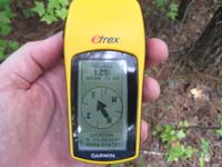
| − | Image:2009090233-84NW01.JPG| | + | Image:2009090233-84NW01.JPG| 1.25 feet to go. Close enough. |
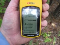
| + | Image:2009090233-84NW02.JPG| Time of the meetup. | ||
| + | Image:2009090233-84NW03.JPG| Date of the meetup. | ||
</gallery> | </gallery> | ||
| Line 34: | Line 47: | ||
[[Category:Coordinates reached]] | [[Category:Coordinates reached]] | ||
[[Category:Expeditions with photos]] | [[Category:Expeditions with photos]] | ||
| + | {{location|US|GA|SD}} | ||
Latest revision as of 02:43, 6 August 2019
| Wed 2 Sep 2009 in Atlanta: 33.2813819, -84.3347528 geohashing.info google osm bing/os kml crox |
Graticule
About
Deep into the woods north of Griffin.
Expedition
NWoodruff
Looking at the Google map, it appears that there is a long dirt road leading to close to the hash point. I drove up to the dirt road and as I turned on it, it was clear that it is a driveway. There is now a gate with a fence. There is enough room for my truck to be on the dirt drive way and off the road in front of the gate. I hopped out of my truck and started taking pictures of the gate and the no trespassing signs.
I got my eTrex out of the truck and made it back to the gate to get a picture of the closest point. As I was standing at the gate about to take a picture, a woman comes out of the house about 100 feet away and questions what I am doing.
I explain a little about Geohashing, I show her the Google map with the dirt road and the picture of her house, explain how the point is calculated and how lucky she is to get a hash point on her property and why I want to go to that spot. To her it seemed like she had won the lottery.
She said that it was okay for me to find the spot and she wanted to go with me. The dirt road now is very over grown but I found the closest point from the dirt road to the actual geohash point. The direct path to the hash point from the road is very thick brush. The woman followed me in for about 100 feet but there was another 300 feet to go.
I found my way the last 300 feet on my own. I took a few pictures and climbed my way back out. She asked me if I had found the spot and I said that I did. We walked back together. I thanked her and asked her, her name. She told me and I don't remember what it is. It is a Spanish name. She was born in Puerto Rico and both her parents are Spanish. I thanked her in Spanish and then left.
I then drove to Norcross.
Gallery
- Photo Gallery
Achievements
NWoodruff earned the Land geohash achievement
|


