Difference between revisions of "2009-10-07 38 -9"
imported>Davidc (write up done, photos are still uploading) |
imported>Davidc (A cheap temporary hack to get the photos to automatically appear when Commonist is done uploading, since I have to go out now.) |
||
| Line 44: | Line 44: | ||
== Photos == | == Photos == | ||
| + | {{:User:davidc/gallery}} | ||
| + | |||
| + | <!-- | ||
=== Going to the hash === | === Going to the hash === | ||
| Line 63: | Line 66: | ||
<gallery perrow="4"> | <gallery perrow="4"> | ||
</gallery> | </gallery> | ||
| + | --> | ||
== Ribbons == | == Ribbons == | ||
Revision as of 18:41, 7 October 2009

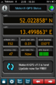
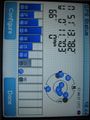
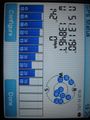
| Wed 7 Oct 2009 in 38,-9: 38.4156129, -9.2083447 geohashing.info google osm bing/os kml crox |
Location
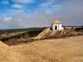
Cabo Espichel, near Sesimbra, Portugal.
Participants
Plans
Since I've been at the RIPE meeting in Lisbon all week, I've been waiting for a good set of coordinates to deflower the graticule with. You couldn't really ask for a better location than today's, on a picturesque headland about 50km south of the city.
Expedition
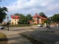
I ducked out of the afternoon sessions and set off on my adventure. Not really sure how reliable Portugese public transportation would be, it was with some trepidation that I waited for the 13:45 207 bus to Sesimbra. Luckily it was on time, and I had a few minutes to buy some hashcards in Sesimbra before my 14:50 connection on the 201 to Cabo Espichel. The journey thus far quite uneventful, I took the bus to the last stop, at the convent.
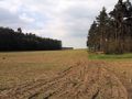
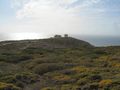
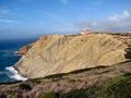
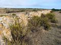
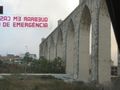
The cliff face exposes billions of years of history due to tectonic movement. Jurassic era dinosaur footprints are visible in the rock. Apparently the locals used to believe these were the footprints of the Virgin Mary. This explains why they built a convent at the top - though it doesn't explain why Christians aren't more terrified about the monumental size and clawed feet of their saviour's mother.
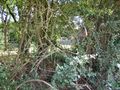
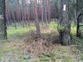
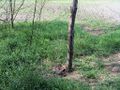
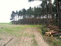
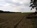
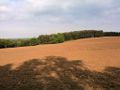
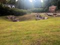
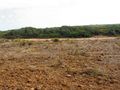
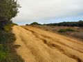
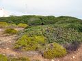
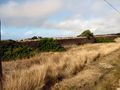
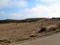
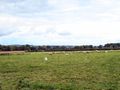
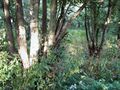
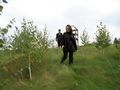
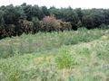
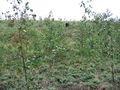
To ease me into hashing in a whole new country, the route to today's coordinates led me across a field. Of course, this being the rocky heathland of Portugal's coast, it was a field of seagulls instead of corn or horses. The hashpoint itself lay a little further in a lush strip of bushes.
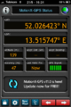
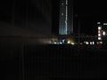
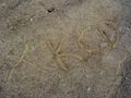
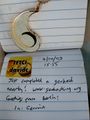
A hash-beetle occupied the exact coordinates, but I wasn't afraid of him. His miniature proportions made him seem almost cute; even rabbitfox could had squashed him with her dainty little paw. Coordinates reached, but with the sun beating down heavily, we didn't tarry long. I wrote out the hashcards (will you be lucky enough to receive one?), scratched a sign into the packed mud, watered a parched hash-bush nearby, and set off toward the lighthouse.
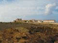
Unusually far inland for such an important lighthouse, the adjoining buildings today appear to be converted to apartments. Round the back we found the geocache GC173T7 into which I finally managed to drop a geocoin I've been carrying from Berlin through England.
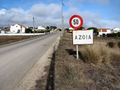
Getting back was somewhat more problematic. The next bus heading back didn't come as far as Cabo Espichel, but only to Azoia. Fortunately it was an hour away so I had time to walk. On the way I followed an inexplicable wall along the entire route, which turned out to be a little aqueduct going to the convent.
I arrived in Azoia just in time to tank a bottle of water and a Red Bull before boarding the 201 back toward Sesimbra. This time I got off early at Santana in order to be in time for the next connection back to Lisboa. The mist rolls in and out quickly in this part of the world, and it overtook us as we reached Santana.
And that's where I am now, writing the report on the bus home. Portugal's sun-parched countryside isn't much to look at, and I have to shower and head out again as soon as I get back to the hotel.
I hereby claim the Virgin Graticule achievement for the first geohash in 38,-9. In fact, unless I'm very much mistaken, I just deflowered the whole country. Hooray!
Photos
Sat Jul 24 13:36:21 BST 2010
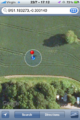
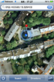
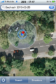
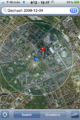
iPhone map proof.
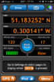
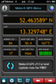
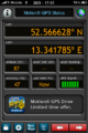
iPhone GPS proof.
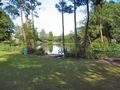
Fishing lake.
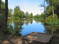
Fishing lake.
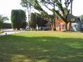
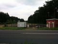
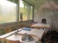
Clubhouse.
Hash field on left across ditch.
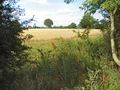
VIew into hash field.
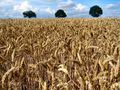
Corny.
Hash field.

Perplexed.
There she is!
Where's rabbitfox?
Clubhouse just visible through trees.
Closer shot for proof.
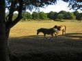
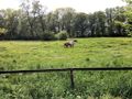
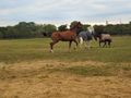
Horses.

Horse.


Fri Jun 25 12:04:50 CEST 2010
iPhone map proof, of sorts.
GPS proof, of sorts.

Newfangled heat has wilted our grins.
Potential hashpoint A.
Potential hashpoint B.
Potential hashpoint A from another angle.
A nice tree-lined street for the hash.

Rabbitfox finds the rose geocache.

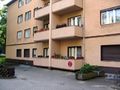
A funny way to adhere to building code - Edeka's carpark, with the facade of the original building left intact (there was a geocache here).


Fri May 21 21:54:43 CEST 2010
Horsies by Baruth station.
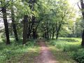
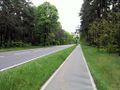
Tree-lined avenue from station to the Baruth park.
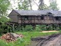
A very cool but dilapidated building on stilts next to the rather marshy park.
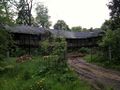
Not long for this world.
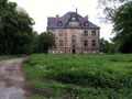
Baruth park castle.
A travel bug and a gigantic oak holding geocache GC27F0Q.
Walking down the road toward Klasdorf.
Turn-off into what turned out to be a tract of land for a pipeline.
Pipeline pumping or monitoring station?
Mystery Box mark 2 - no box, just a lifeguard's chair!
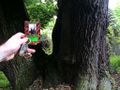
Geodesic survey marker on a tree.
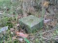
Geodesic survey stone.
Marker and stone together.
GPS coords of the marker.
Where in Berlin they number every single tree, out here in Brandenburg they only number each section of forest :-)
The pipeline tract opens up into a larger field, the hashpoint is beyond the far line of trees, but... an electric fence!
Fortunately the fence ends abruptly and shows it was there for no reason at all.
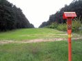
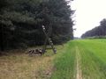
Looking down the hashfield. The hashpoint is beyond the mystery box.
And turning the corner to see the hashpoint in the dead centre of this photo.
iPhone map proof.
iPhone GPS proof.

That's a cake. With two candles.
A tractor crosses the top of the hash field.
No poster, left a card. The tree sap is coming out in the strong sun.
After a flat journey, heading downward back into civilisation.
Baruth has a few of these strange underground cellars dotted around in public places - not connected to any private property.
Roundabout joining the two major roads running through Baruth.


Fri May 21 20:17:24 CEST 2010
iPhone GPS proof.
iPhone map proof.
Hashcellar
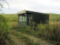
Boarded up hashhouse.

This place is giving us the willies.
Hashhouse side wall.
Hashpoint and boarded up house hiding in the trees.
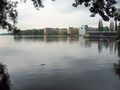
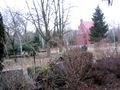
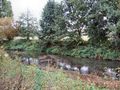
Looking across the Rummelsberger See.
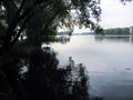
View down the Rummelsburger See from safety.

View from the other side of the lake. Just because.


Wed May 12 02:41:49 CEST 2010
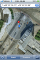
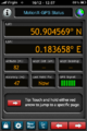
iPhone Map proof. Wide inaccuracy due to neighbouring tall buildings, but we positioned ourselves accurately by map. Time: 23:59.
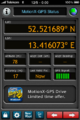
iPhone GPS proof at 00:00.

The early birds catch the midnight geohash.
South: Alexa shopping mall.
West: Park Inn tower.

East.

Northeast.
Northwest: Alexanderplatz ecke Alexanderplatz.

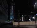
The full night-time geohashing lineup.

And again for safety (and because rabbitfox was indigant).
Our poster
Proof that you can see Alexoase from the hashpoint.

Alexoase from the front.

And us inside the bar.


Sat Mar 20 21:27:45 CET 2010
iPhone map proof
iPhone GPS proof
Tee hee hee.
Observation platform just before the hashpoint.
Carpark. Woman is on the hashpoint.

Hash cart.

Success!
Pond across the road.
Hash card.

Graveyard entrance.
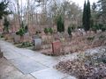
Part of the enormous graveyard complex.
The three adjacent graveyards mistrust each other so much they have fences in between.

Plane landing at TXL.


Sun Mar 14 19:21:40 CET 2010


Wed Dec 30 19:04:59 GMT 2009
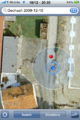
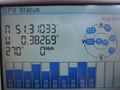
GPS screenshot
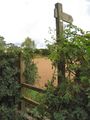
Stile
Dungfire
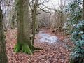
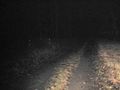
Sodden footpath
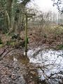
A choice of four public swamp-paths
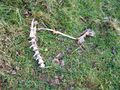
Hash-carcass

Silly grin!
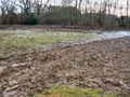
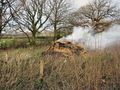
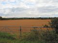
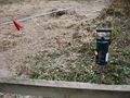
Frozen hash-field
Unfrozen hash-field
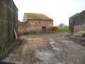
Farm buildings
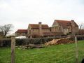
Farmhouse
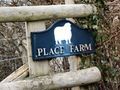
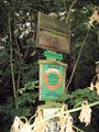
Farm sign


Thu Dec 10 23:14:11 CET 2009

iPhone Cheaper GPS "There/Not There" mode proof

iPhone Cheaper GPS "Warmer/Colder" mode proof
iPhone map proof
Our poster
The Sommergarten was not open


Fri Dec 04 21:05:14 CET 2009

The erotic massage parlour next door.
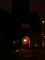
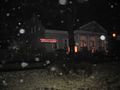
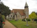
The church in front of the hashpoint

Church again
No GPS reception in the hof


Sun Nov 29 02:55:38 CET 2009

iPhone map proof
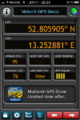
iPhone GPS proof
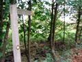
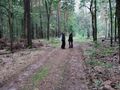
Entering the haunted forest

A madman on the loose
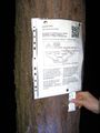
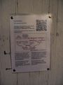
Poster
relet tests the QR code

Grins
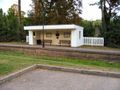
Nassenheide station


Wed Oct 07 20:45:45 BST 2009

First bus, Lisbon to Sesimbra.

Second bus, Sesimbra to Cabo Espichel.
View from the monastery.
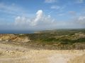
View from the monastery.
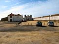
The monastery.
My bus in front of the monastery.
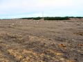
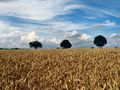
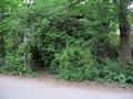
A field of seagulls.
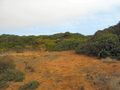
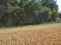
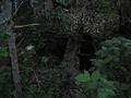
Green hides the hashpoint.
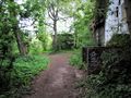
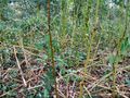
A blockage before the hash ...
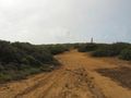
... a sidetrack ...
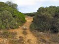
... and a way through ...
... to the hashpoint.
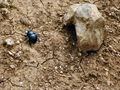
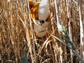
The hash-beetle.
GPS Proof.

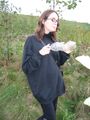
Me & rabbitfox grinning.

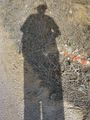
rabbitfox impersonating davidc.
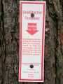
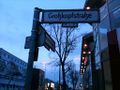
Signage.
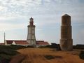
Lighthouse. Actual Size!!!
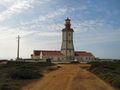
Lighthouse.
Geocache drop.
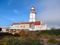
Back of the lighthouse.
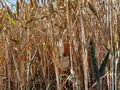
Geocache bush.
The lighthouse should be over there, really.
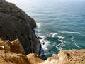
Rocky.
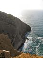
Rockier.
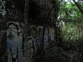
Millions of years of rock.
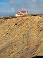
The monastery perched on top.
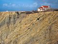
The monastery and the rocks.
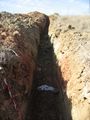
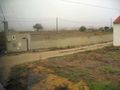
A fresh ditch by the road. No doubt to bring FTTH to the residents of the lighthouse.
A dubious wall ...
... turned out to be an aqueduct for the monastery.
... along the whole route back ...

How cool is that?
Typically half-arsed attempts at building houses.
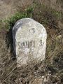
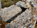
Milestone.

That's not sunlight forcing my eyes shut, that's a river of sweat that even my big fat eyebrows can't divert.
A much more dignified photo of myself at this point.
The first town! Bus stop not far away.

rabbitfox double-checks the hashcards.
The fog quickly overtakes the bus.
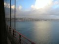
The bridge ...
... crossing ...
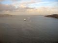
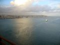
... the strait ...
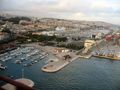
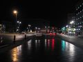
... back to Lisbon. The docks.
And the aqueduct in the middle of the city.


Thu Oct 01 23:54:02 BST 2009
Coordinates reached!

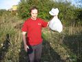
I was so hungry I almost ate rabbitfox...
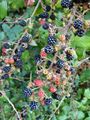
... fortunately there were some hash-berries nearby.
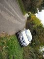
If you park your hash-car at a cute angle...

... you get a free tank of magical hash-fuel!


Thu Oct 01 23:19:24 BST 2009
Figuring out the best way to proceed

Thu Oct 01 23:15:03 BST 2009
These are not hash-sheep, but that is the hash-field on the left.
Public footpaths rule.

Coordinates reached!

Silly grins.
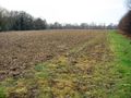
The freshly ploughed hash-field.


Thu Oct 01 22:52:07 BST 2009

Me in front of the Torchwood 3 Hub!

The Torchwood "main entrance" has become a shrine to Ianto Jones.

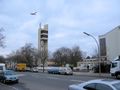
Torchwood, a.k.a. the Welsh Millenium Centre in Cardiff


Thu Oct 01 22:44:00 BST 2009

Sad at another failure.
GPS at the previous photo point, not the closest I got, but I couldn't take photos at their front door.


Thu Oct 01 13:47:52 BST 2009
GPS at the hashpoint

Face off.


Wed Sep 30 23:03:15 BST 2009
The dried-up river bed.
The hashpoint. Maybe I'm Moses.
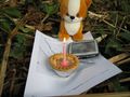
Cake, hashscot and GPS at the hashpoint.

Making a wish.

Happy Origin Day To Me!
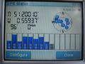
~2m inaccuracy.
Former Bramley and Wonersh station.


Wed Sep 30 22:12:35 BST 2009
School church
A river separated me and the hashpoint from the north.
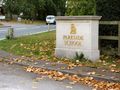
School 1

School 2
A public footpath! Barely a track through the woods.
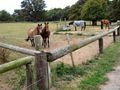
Keep going. We are not the hash-horses you are looking for.
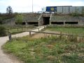
The M25 and a tunnel.
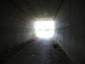
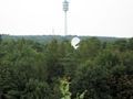
The hash-light at the end of the tunnel.
Bzzt. Bzzt. Bzzt. I am often tempted to wee on one of these.

I am the Guardian of the Hash.
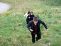
Look at us galloping to the hashpoint. Nyer!
As close as I could get.
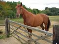
My selfish need for a grazing field may have denied you a hash, but I would still like to be your friend.
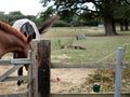
The hashpoint is approximately at the metal feeding bin in the distance.
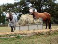
Even blindfolded, hash-horses can smell your GPS,

Silly frown. Onward!


Mon Sep 28 10:32:14 BST 2009

Rabbitfox is unimpressed with the use of a TomTom for hashing.
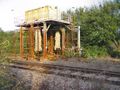
Disused train wash.
Geotrashing the right way.


Thu Sep 24 13:06:18 BST 2009


Tue Sep 15 20:14:41 CEST 2009
Entrance to the forest
Forest path
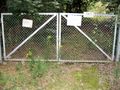
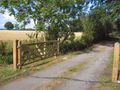
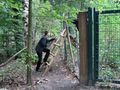
The first hurdle. "Please shut this gate behind you"... but a padlock.
"I can feel the hash!"
behind a fence.
The adjacent golf course
A convenient stile grants access.
The sign reads something like "Please don't come in". Not forbidden, just asking nicely.
Up the bluff to the hashpoint?
Why exactly does a golf course needs such a huge satellite dish?
Back down the bluff to the hashpoint?
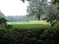
Hash "field"
Slowpokes
Coordinates reached!

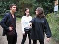
Two fresh silly grin recruits.
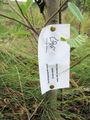
Hash sapling.
The reverse geotrash begins.
Contents: Book, coffee cup, first aid kit, and a calendar dated 1990.
An office portacabin by the entrance.
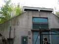
The mysterious bunker.
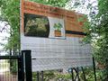
About the landfill and planting.

Reverse geotrash completed!


Wed Sep 09 00:00:49 CEST 2009


Wed Sep 02 18:51:09 CEST 2009


Tue Sep 01 21:28:40 CEST 2009


Tue Sep 01 21:23:11 CEST 2009

