Difference between revisions of "2009-10-10 32 -111"
From Geohashing
imported>Wyle & RoadRunner (New page: {{meetup graticule | map=<map lat="32" lon="-111" date="2009-10-10" /> | lat=32 | lon=-111 | date=2009-10-10 | graticule_name=Casa Grande | graticule_link=Casa Grande, Arizona}} == Expedit...) |
imported>FippeBot m (Location) |
||
| Line 20: | Line 20: | ||
[[Category:Expeditions with photos]] | [[Category:Expeditions with photos]] | ||
[[Category:Coordinates reached]] | [[Category:Coordinates reached]] | ||
| + | {{location|US|AZ|PM}} | ||
Revision as of 06:14, 8 August 2019
| Sat 10 Oct 2009 in Casa Grande: 32.4970651, -111.3456340 geohashing.info google osm bing/os kml crox |
Expeditions
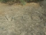
A nice expedition into a VERY dusty area. Used 4 wheel drive to get through the silt and kicked up a huge dust cloud. Treked over packed silt flood berms, through a dense thicket of pre-tumbleweeds (as in still growing), and through a mini-forest of Tamarisk trees to get to the final location.
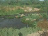
On the way out, we sidetracked to the edge of the Santa Cruz River and saw a couple heron enjoying the area. We also stopped to look at a couple old abandon farm buildings. One looked like a nice fixer-upper until we saw the large cracks in the north wall. Must have been a nice place in its day. RoadRunner was already figuring where the outdoor fountain would go.


