Difference between revisions of "2009-10-14 47 8"
From Geohashing
imported>Crox (added some expedition details) |
imported>Crox m (added participants section for easier automated parsing) |
||
| Line 9: | Line 9: | ||
Location: a field in Ottenhusen (part of [http://en.wikipedia.org/wiki/Hohenrain Hohenrain] municipality) | Location: a field in Ottenhusen (part of [http://en.wikipedia.org/wiki/Hohenrain Hohenrain] municipality) | ||
| − | == | + | |
| + | ==Participants== | ||
| + | *[[user:Crox|Crox]], with a group of Swiss Army infantry explorers | ||
| + | |||
| + | |||
| + | ==Expedition== | ||
A [http://en.wikipedia.org/wiki/Swiss_Army Swiss Army] team lead by [[User:Crox|Crox]] was on a reconnaissance mission in the area with two vehicles and enough time left to quickly stop at the hash. | A [http://en.wikipedia.org/wiki/Swiss_Army Swiss Army] team lead by [[User:Crox|Crox]] was on a reconnaissance mission in the area with two vehicles and enough time left to quickly stop at the hash. | ||
Revision as of 22:00, 16 January 2010
| Wed 14 Oct 2009 in 47,8: 47.1642309, 8.3248563 geohashing.info google osm bing/os kml crox |
About
Location: a field in Ottenhusen (part of Hohenrain municipality)
Participants
- Crox, with a group of Swiss Army infantry explorers
Expedition
A Swiss Army team lead by Crox was on a reconnaissance mission in the area with two vehicles and enough time left to quickly stop at the hash.
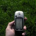
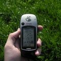
Not much to say about the location, as can be seen on the pictures the grass was really green and the house just next to the spot looked a bit creepy.


