Difference between revisions of "2009-11-16 44 -92"
From Geohashing
imported>Rhonda (getting it started. don't have time to write the full report right now.) |
imported>Trane m (Add photo) |
||
| Line 20: | Line 20: | ||
== Photos == | == Photos == | ||
| + | <gallery perrow="4"> | ||
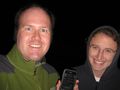
| + | Image:2009.11.16.44.-92.jpg|Coordinates Reached | ||
| + | </gallery> | ||
[[Category:Expeditions]] | [[Category:Expeditions]] | ||
| + | [[Category:Expeditions with photos]] | ||
[[Category:Coordinates reached]] | [[Category:Coordinates reached]] | ||
Revision as of 20:29, 8 February 2010
| Mon 16 Nov 2009 in 44,-92: 44.2014237, -92.9806932 geohashing.info google osm bing/os kml crox |
Contents
Location
In the middle of a road, near Kenyon.
Participants
Plans
Drive there after work and meet for a dark geohash. Remember the flashlights this time.
Mark phoned Rhonda near the end of her work day to let her know that there was a geohash between the two of them, on a road, and that this was a perfect opportunity to return Rhonda's camera, which she had lost while golfing on Saturday. As Rhonda has no internet at work at this site, Mark provided directions from her location to the hash point over the phone.
Expedition
Photos
Coordinates Reached
