Difference between revisions of "2010-01-20 44 -92"
imported>Yuwtze (create page) |
imported>FippeBot m (Location) |
||
| (4 intermediate revisions by one other user not shown) | |||
| Line 1: | Line 1: | ||
| + | [[Image:2010-01-20 44 -92 Nathan.jpg|thumb|left]] | ||
| − | |||
| − | |||
| − | |||
| − | |||
| − | |||
| − | |||
{{meetup graticule | {{meetup graticule | ||
| lat=44 | | lat=44 | ||
| Line 15: | Line 10: | ||
__NOTOC__ | __NOTOC__ | ||
== Location == | == Location == | ||
| − | + | In a field near a subdivision. | |
== Participants == | == Participants == | ||
| − | + | [[User:Yuwtze|Nathan]] | |
== Plans == | == Plans == | ||
| + | [[User:Yuwtze|Nathan]] looked up today's hashpoint on a whim about 7:30 pm, and discovering it is less than 10 minutes away, aimed for a hash between 8 and 9 pm. | ||
| + | == Expedition == | ||
| + | ===Nathan=== | ||
| + | This was a truly spontaneous hash--I left the house within 30 minutes of finding the location. I had boots and cold-weather gear, a flashlight, and my camera-phone. I'd misplaced my camera a week or two ago, and so I would be without flash photography. | ||
| − | + | As I was driving away from home, I had the thought that I might spontaneously be able to get the Tron Achievement. Less than 10 minutes later, I got off the freeway and observed a gas station that I hadn't seen on the imagery. I proceeded North up the road to the first right turn, and nearly turned onto an unplowed road with a locked gate. Clearly, this was not my turn. I continued further and found a right turn, but was quickly able to identify it as the road that was supposed to be the third right--I'd gone past the hash. At this point, I realized why "spontaneous" and Tron Achievement" don't often appear together. I turned around, drove back the other way, and turned into the second right (though now a left), which I was able to realize was a long private driveway. I turned around again, and continued South toward the gas station, pulling into a left turn lane only to realize with a start that I had nearly turned onto the gated road a second time. A quick merge back into the travel lane set things right, and I pulled into the gas station to reconcile my observations with the map. | |
| + | It became clear that the gated road was in fact the road I'd planned to take to make my closest approach to the hash. Since I wasn't going to be able to park any closer than I was, I decided to attempt it on foot. It was now a minute or two past 8:00. As I walked down the access road to the gas station, I observed the first indication that I was about to get the No-Trespassing consolation Prize--a small do not enter sign indicating that snowmobiles should not enter the field, but proceed along the shoulder of the access road. | ||
| − | + | About halfway up to the gated road, there was the second indication--a large sign proclaimed that this location was the "Lake Elmo Sod Farm" offering both delivery and field pickup, and a much smaller sign below, reading "PRIVATE PROPERTY No Trespassing". However, I continued to the gated road, as the hash was North of the road, and maybe would be on property with a different owner. | |
| + | AS I approached, I noticed the high-voltage lines above the gated road, and realized that it was in fact an access road for the powerlines, and that it, too was signed as a private road. For thoroughness, I continued North until I reached a point that I judged to be due West of the hash point, then turned around and returned to my car, stopping to photograph the signs as best as I could with a cameraphone and a maglite. I took a flashlight-under-the-chin mug in front of the sod farm sign, and returned to the car at precisely 8:30pm. | ||
== Photos == | == Photos == | ||
| − | + | ||
<gallery perrow="4"> | <gallery perrow="4"> | ||
| − | Image: | + | Image:2010-01-20 44 -92 first sign.jpg | First Sign: "Do Not Enter" |
| − | Image: | + | Image:2010-01-20 44 -92 second sign.jpg | Second Sign: "No Trespassing" |
| + | Image:2010-01-20 44 -92 gate.jpg | Gate: "Private Road" | ||
| + | Image:2010-01-20 44 -92 Nathan.jpg | Mugging at the second sign, with a flashlight pointed at my face. | ||
| + | |||
</gallery> | </gallery> | ||
| − | |||
| − | |||
| − | |||
| − | + | [[Category:Expeditions]] | |
| − | |||
| − | [[Category: | ||
| − | |||
| − | |||
| − | |||
| − | |||
[[Category:Expeditions with photos]] | [[Category:Expeditions with photos]] | ||
| − | |||
[[Category:Expedition without GPS]] | [[Category:Expedition without GPS]] | ||
| − | |||
| − | |||
| − | |||
| − | |||
| − | + | ||
[[Category:Coordinates not reached]] | [[Category:Coordinates not reached]] | ||
| − | + | ||
| − | |||
[[Category:Not reached - No public access]] | [[Category:Not reached - No public access]] | ||
| − | + | {{location|US|MN|WH}} | |
| − | |||
| − | |||
Latest revision as of 03:02, 6 August 2019

| Wed 20 Jan 2010 in 44,-92: 44.9573660, -92.8584263 geohashing.info google osm bing/os kml crox |
Location
In a field near a subdivision.
Participants
Plans
Nathan looked up today's hashpoint on a whim about 7:30 pm, and discovering it is less than 10 minutes away, aimed for a hash between 8 and 9 pm.
Expedition
Nathan
This was a truly spontaneous hash--I left the house within 30 minutes of finding the location. I had boots and cold-weather gear, a flashlight, and my camera-phone. I'd misplaced my camera a week or two ago, and so I would be without flash photography.
As I was driving away from home, I had the thought that I might spontaneously be able to get the Tron Achievement. Less than 10 minutes later, I got off the freeway and observed a gas station that I hadn't seen on the imagery. I proceeded North up the road to the first right turn, and nearly turned onto an unplowed road with a locked gate. Clearly, this was not my turn. I continued further and found a right turn, but was quickly able to identify it as the road that was supposed to be the third right--I'd gone past the hash. At this point, I realized why "spontaneous" and Tron Achievement" don't often appear together. I turned around, drove back the other way, and turned into the second right (though now a left), which I was able to realize was a long private driveway. I turned around again, and continued South toward the gas station, pulling into a left turn lane only to realize with a start that I had nearly turned onto the gated road a second time. A quick merge back into the travel lane set things right, and I pulled into the gas station to reconcile my observations with the map.
It became clear that the gated road was in fact the road I'd planned to take to make my closest approach to the hash. Since I wasn't going to be able to park any closer than I was, I decided to attempt it on foot. It was now a minute or two past 8:00. As I walked down the access road to the gas station, I observed the first indication that I was about to get the No-Trespassing consolation Prize--a small do not enter sign indicating that snowmobiles should not enter the field, but proceed along the shoulder of the access road.
About halfway up to the gated road, there was the second indication--a large sign proclaimed that this location was the "Lake Elmo Sod Farm" offering both delivery and field pickup, and a much smaller sign below, reading "PRIVATE PROPERTY No Trespassing". However, I continued to the gated road, as the hash was North of the road, and maybe would be on property with a different owner.
AS I approached, I noticed the high-voltage lines above the gated road, and realized that it was in fact an access road for the powerlines, and that it, too was signed as a private road. For thoroughness, I continued North until I reached a point that I judged to be due West of the hash point, then turned around and returned to my car, stopping to photograph the signs as best as I could with a cameraphone and a maglite. I took a flashlight-under-the-chin mug in front of the sod farm sign, and returned to the car at precisely 8:30pm.
Photos
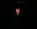
First Sign: "Do Not Enter"

Second Sign: "No Trespassing"
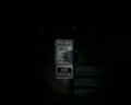
Gate: "Private Road"
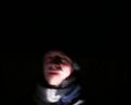
Mugging at the second sign, with a flashlight pointed at my face.


