Difference between revisions of "2010-03-18 48 8"
From Geohashing
imported>Ekorren m (template only so far) |
imported>Ekorren (gallery) |
||
| Line 19: | Line 19: | ||
<gallery> | <gallery> | ||
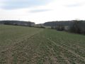
| + | File:2010-03-18_48_8_Teufelsbruecke.jpg|Through the Schönbuch forest... | ||
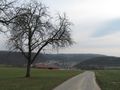
| + | File:2010-03-18_48_8_Mauren.jpg|... over country roads and tracks ... | ||
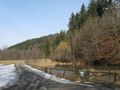
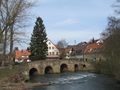
| + | File:2010-03-18_48_8_Wuermtal.jpg|... into the Würm valley. | ||
| + | File:2010-03-18_48_8_blink.jpg|''When there's blinking light, usage of the foot- and cycleway is forbidden due to flooding of the underpass'' | ||
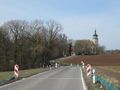
| + | File:2010-03-18_48_8_WeilderStadt.jpg|Weil der Stadt | ||
| + | File:2010-03-18_48_8_Hausen_Wuermbruecke.jpg|Old Würm bridge at Hausen | ||
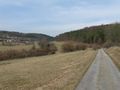
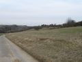
| + | File:2010-03-18_48_8_Moensheim.jpg|View over the hills | ||
| + | File:2010-03-18_48_8_Hash_from_far.jpg|Hash must be over there | ||
| + | File:2010-03-18_48_8_Hashpoint.jpg|The hash field | ||
| + | File:2010-03-18_48_8_GPS.jpg|Coordinates reached | ||
| + | File:2010-03-18_48_8_Iptingen.jpg|Hash village: Iptingen | ||
| + | File:2010-03-18_48_8_Iptingen_pig.jpg|Inhabitant of hash village | ||
| + | File:2010-03-18_48_8_Nussdorf_sign.jpg|''Sun mountain 2 km''<br>''Worries mill 1.5 km''<br>Ground worries, anyone? | ||
| + | File:2010-03-18_48_8_Snowdrop.jpg|It's finally getting spring! | ||
| + | File:2010-03-18_48_8_Enztalviadukt.jpg|Bridge of the high speed railway line Stuttgart-Mannheim | ||
| + | File:2010-03-18_48_8_Geese.jpg|Beware of poultry on the road! | ||
| + | File:2010-03-18_48_8_Geese_2.jpg | ||
</gallery> | </gallery> | ||
Revision as of 00:08, 20 March 2010
| Thu 18 Mar 2010 in 48,8: 48.8837305, 8.8866459 geohashing.info google osm bing/os kml crox |
Contents
Location
Above Wiernsheim-Iptingen. It's a field.
Participants
Expedition
Photos
Through the Schönbuch forest...
... over country roads and tracks ...
... into the Würm valley.
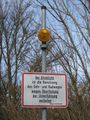
When there's blinking light, usage of the foot- and cycleway is forbidden due to flooding of the underpass

Weil der Stadt
Old Würm bridge at Hausen
View over the hills
Hash must be over there
The hash field
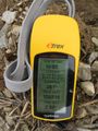
Coordinates reached
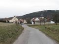
Hash village: Iptingen
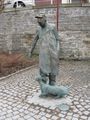
Inhabitant of hash village
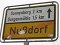
Sun mountain 2 km
Worries mill 1.5 km
Ground worries, anyone?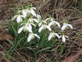
It's finally getting spring!
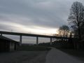
Bridge of the high speed railway line Stuttgart-Mannheim
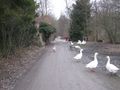
Beware of poultry on the road!