Difference between revisions of "2010-06-12 40 -90"
imported>Dvdllr |
imported>Dvdllr |
||
| Line 12: | Line 12: | ||
== Plans == | == Plans == | ||
| + | Preparation included bringing the standard fare: GPS, camera, ambassador form, mini flag. I noticed that from my house it looked like a storm was moving in, so I monitored the weather where I was going, and saw that there was significant rain happening there. That prompted my ratty shoes, but for some reason it didn't occur to me to bring a decent umbrella. | ||
== Expedition == | == Expedition == | ||
| − | I | + | Of all the expeditions I've made so far over the last year, this was actually the first one I've done on a Saturday, which prompted me to aim for 4:00 so it would be official. This was also my first venture outside the [[Peoria, Illinois|Peoria]] graticule, and the first for [[Galesburg, Illinois|Galesburg's]] at all. I bid farewell to my wife, since she wasn't coming along, and started driving there after punching the coordinates into the GPS. It was expected to take about an hour, maybe a little more, so I left at quarter to three. I had no expectation of finding any other geohashers there, but I still felt it important enough to be there at the right time in case any one else was. |
| + | |||
| + | After driving about ten minutes, I reached the leading edge of the rain storm, and I spent the rest of the expedition in said rain (which stopped about 20 seconds after I arrived back home). The showers were wildly varying in their intensity, so I really wasn't able to predict what it might be like when I get to where I'm going. | ||
| + | |||
| + | (The thrilling conclusion will be written after I get back from church, stay tuned) | ||
== Photos == | == Photos == | ||
Revision as of 13:48, 13 June 2010
| Sat 12 Jun 2010 in 40,-90: 40.8070820, -90.1346896 geohashing.info google osm bing/os kml crox |
Location
Next to Spoon River, near the village of Maquon, Illinois
Participants
Plans
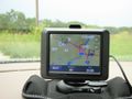
Preparation included bringing the standard fare: GPS, camera, ambassador form, mini flag. I noticed that from my house it looked like a storm was moving in, so I monitored the weather where I was going, and saw that there was significant rain happening there. That prompted my ratty shoes, but for some reason it didn't occur to me to bring a decent umbrella.
Expedition
Of all the expeditions I've made so far over the last year, this was actually the first one I've done on a Saturday, which prompted me to aim for 4:00 so it would be official. This was also my first venture outside the Peoria graticule, and the first for Galesburg's at all. I bid farewell to my wife, since she wasn't coming along, and started driving there after punching the coordinates into the GPS. It was expected to take about an hour, maybe a little more, so I left at quarter to three. I had no expectation of finding any other geohashers there, but I still felt it important enough to be there at the right time in case any one else was.
After driving about ten minutes, I reached the leading edge of the rain storm, and I spent the rest of the expedition in said rain (which stopped about 20 seconds after I arrived back home). The showers were wildly varying in their intensity, so I really wasn't able to predict what it might be like when I get to where I'm going.
(The thrilling conclusion will be written after I get back from church, stay tuned)
Photos
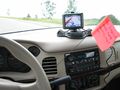
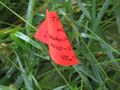
Just getting started. I didn't fill in the date on the flag in case I didn't make it.
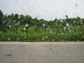
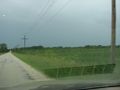
From the road, the hashpoint is in this general direction.
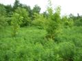
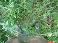
A terribly blurry picture, but it's the only one I took while traipsing towards the point.
Geohashing
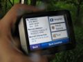
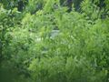
This is it!
I claim this land for geohashing
My car, viewed from the hashpoint (zoomed in)
Spoon River bridge
Mr. Soggy Shorts

Well that was an adventure

I didn't stop in to see if Miracle Max was there
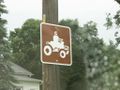
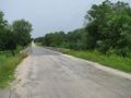
You know you're in a small town when...
Re-approching the hashpoint, you see where the field meets the jungle
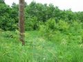
An orange flag lies somewhere in the wilderness
I don't have time for this!
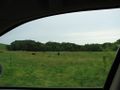
Moo

Half a drowned rat


Achievements
Dvdllr earned the Land geohash achievement
|
Dvdllr earned the Drowned Rat Geohash Honourable Mention
|