Difference between revisions of "2010-07-22 44 -69"
From Geohashing
imported>UncleOp m |
imported>UncleOp m (→Achievements) |
||
| Line 45: | Line 45: | ||
{{#vardefine:ribbonwidth|800px}} | {{#vardefine:ribbonwidth|800px}} | ||
<!-- Add any achievement ribbons you earned below, or remove this section --> | <!-- Add any achievement ribbons you earned below, or remove this section --> | ||
| + | {{land geohash | ||
| + | | latitude = 44 | ||
| + | | longitude = -69 | ||
| + | | date = 2010-07-22 | ||
| + | | name = [[User:UncleOp|Del]] | ||
| + | }} | ||
{{Virgin graticule | {{Virgin graticule | ||
Revision as of 04:04, 23 July 2010
| Thu 22 Jul 2010 in 44,-69: 44.2875466, -69.3982983 geohashing.info google osm bing/os kml crox |
Location
Just off the road, to the south of a residence. Farther east, but not visible, is a lake.
Participants
Del, who added a bunch of the Maine graticules way back when and finally got around to doing a run.
Plans
Expedition
Del was heading to a rehearsal of the annual Conductor's Retreat and noticed that the hash was not far away. So he left early to do the hash during daylight. Arrived around 7pm, parked on the other side of the road, and wandered into the yard. The GPS - just a car-based TomTom GO-510 - didn't like walking, so based on home research, the location was really-really close.
Next time should be with a group; solo wasn't all that interesting.
Tracklog
Photos
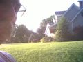
Del with house in background
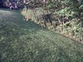
Boring picture of location
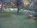
Another boring picture


Achievements
Del earned the Land geohash achievement
|