Difference between revisions of "2010-07-29 45 -122"
From Geohashing
imported>Jiml (Add Photos) |
imported>FippeBot m (Location) |
||
| (One intermediate revision by one other user not shown) | |||
| Line 1: | Line 1: | ||
| − | + | [[Image:{{{image|2010-07-29_45_-122-area1.jpg}}}|thumb|left]] | |
| − | |||
| − | |||
| − | |||
| − | |||
| − | |||
| − | |||
| − | |||
{{meetup graticule | {{meetup graticule | ||
| lat=45 | | lat=45 | ||
| Line 17: | Line 10: | ||
__NOTOC__ | __NOTOC__ | ||
== Location == | == Location == | ||
| − | In a neighborhood south of King City, Oregon, adjacent to | + | In a neighborhood south of King City, Oregon, perhaps adjacent to a park. |
| − | a | ||
== Participants == | == Participants == | ||
| Line 33: | Line 25: | ||
The hashpoint appeared to be in on private property. There was supposed | The hashpoint appeared to be in on private property. There was supposed | ||
| − | to be a park nearby, which is where he thought | + | to be a park nearby, which is where he thought the hashpoint was actually located, but he couldn't |
actually get | actually get | ||
| − | + | into that park. | |
| Line 59: | Line 51: | ||
[[Category:Not reached - No public access]] | [[Category:Not reached - No public access]] | ||
| + | {{location|US|OR|MU}} | ||
Latest revision as of 03:01, 9 August 2019
| Thu 29 Jul 2010 in 45,-122: 45.4739393, -122.5191685 geohashing.info google osm bing/os kml crox |
Location
In a neighborhood south of King City, Oregon, perhaps adjacent to a park.
Participants
Plans
Jim printed out a Google Map and programmed the GPS.
Expedition
Jim left relatively early from work after the previous night's Fiasco.
It took a little longer to get there, but he managed to miss most of the rush hour traffic.
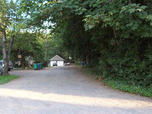
The hashpoint appeared to be in on private property. There was supposed to be a park nearby, which is where he thought the hashpoint was actually located, but he couldn't actually get into that park.
Photos
Achievements
- No Trespassing


