Difference between revisions of "2010-10-02 60 23"
imported>Jusu m (→Location) |
imported>FippeBot m (Location) |
||
| (One intermediate revision by one other user not shown) | |||
| Line 39: | Line 39: | ||
== Photos == | == Photos == | ||
Lighting conditions were a bit challenging for my camera and skills. | Lighting conditions were a bit challenging for my camera and skills. | ||
| − | + | ||
| − | + | <gallery widths=300px heights=225px perrow="3"> | |
| − | |||
| − | <gallery perrow=" | ||
Image:2010-10-02 60 23 Siilitie S IMG 2121 rs.jpg | Road Siilitie. I came from that direction. | Image:2010-10-02 60 23 Siilitie S IMG 2121 rs.jpg | Road Siilitie. I came from that direction. | ||
Image:2010-10-02 60 23 Siilitie N IMG 2120 rs.jpg | Road Siilitie. I parked to the left where the sun shines. | Image:2010-10-02 60 23 Siilitie N IMG 2120 rs.jpg | Road Siilitie. I parked to the left where the sun shines. | ||
| Line 73: | Line 71: | ||
<!-- [[Category:Expeditions with photos]] --> | <!-- [[Category:Expeditions with photos]] --> | ||
[[Category:Coordinates reached]] | [[Category:Coordinates reached]] | ||
| + | {{location|FI|19}} | ||
Latest revision as of 03:58, 9 August 2019

| Sat 2 Oct 2010 in Salo: 60.3421267, 23.2375500 geohashing.info google osm bing/os kml crox |
Location
A hill called Melkkomäki in Muurla, Salo, Finland. Topo map.
Participants
Plans
I'll try to go there if there's enough time after other activities. Distance is about 16 km from home, as the crow flies. A small but probably good enough road leads near the hashpoint. Some 150-200 m walking. Expecting a nice view at least in some point on the hill.
Expedition
Roads were familiar to me except the last kilometer or so. There is a biggish sandpit by a road that connects Salo and Inkoo. Gravel road called Keskipisteentie (Midpoint road) started there. I guess the geographical center of Salo town is somewhere nearby.
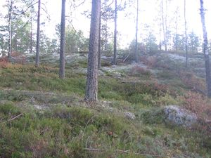
Phone's navigator knew that the name of the next small forest road is Siilitie (Hedgehog road). Only house along the road is near the northern end. I approached from south. Roads were good for driving as they usually are in this type of forest. There is very little undergrowth on sandy soil. I'm not sure what's the correct term in English, but let's call it pine heath.
GPS showed 120 m distance to the destination from the place where I parked. I followed a path where someone had ridden a motocross bike. And there was my grand destination. Not much to tell about it, just see the pictures. Time was 5:00 PM.
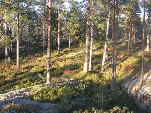
There wasn't a good view exactly on the hashpoint. I followed the path to NW, and found some better sceneries. Collected one beer bottle (empty).
Photos
Lighting conditions were a bit challenging for my camera and skills.
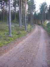
Road Siilitie. I came from that direction.
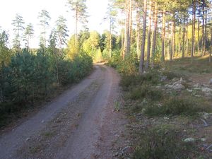
Road Siilitie. I parked to the left where the sun shines.
View to hashpoint
Hashpoint
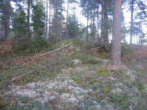
Hashpoint
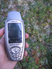
GPS
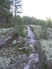
Motocross path
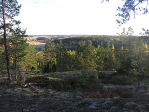
View 1, 300 m from #
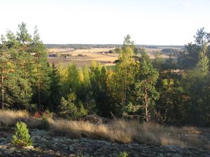
View 2, 300 m from #
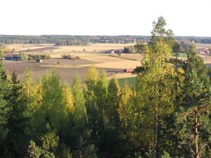
View 3, 300 m from #
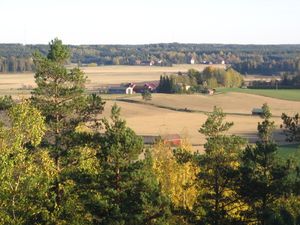
View 4, 300 m from #


Achievements
None. My first expedition without ribbons. (Not true - you get land geohash! - Jim)
Well, if you insist. I thought the ribbon can be earned only once. - Jusu
This user earned the Land geohash achievement
|