Difference between revisions of "2011-01-16 49 8"
From Geohashing
imported>Ilpadre m (→Tracklog) |
imported>Ilpadre (→Photos) |
||
| Line 22: | Line 22: | ||
== Photos == | == Photos == | ||
| + | |||
| + | === ilpadre === | ||
<Gallery> | <Gallery> | ||
| − | - | + | File:2011-01-16 49 8 ilpadre southend revisited 01.jpg|A place worth revisiting many more times in the future. |
| + | File:2011-01-16 49 8 ilpadre southend construction.jpg|Construction already started. | ||
| + | File:2011-01-16 49 8 ilpadre fog.jpg|Fog in Neckarsteinach. | ||
| + | File:2011-01-16 49 8 ilpadre vierburgen.jpg|The four castles Neckarsteinach is famous for (one is behind the tree). | ||
| + | File:2011-01-16 49 8 ilpadre stairstotrail.jpg|Shortcut. | ||
| + | File:2011-01-16 49 8 ilpadre isitspringalready.jpg|It felt like the first day of spring. | ||
| + | File:2011-01-16 49 8 ilpadre bach.jpg|A creek between me and the hashpoint. | ||
| + | File:2011-01-16 49 8 ilpadre bach 2.jpg|I crossed it with dry feet. | ||
| + | File:2011-01-16 49 8 ilpadre stupidgrin.jpg|Obligatory. | ||
| + | File:2011-01-16 49 8 ilpadre lookingup.jpg|At the hashpoint, looking up. | ||
| + | File:2011-01-16 49 8 ilpadre signs.jpg|On the way back. | ||
</Gallery> | </Gallery> | ||
| − | [[Category: | + | [[Category:Expeditions]] |
| + | [[Category:Expeditions with photos]] | ||
| + | [[Category:Coordinates reached]] | ||
Revision as of 21:37, 16 January 2011
| Sun 16 Jan 2011 in 49,8: 49.4094994, 8.8520626 geohashing.info google osm bing/os kml crox |
Location
2 km from Neckarsteinach, uphill and in a forest.
Participants
Expedition
tbd
Tracklogs
- ilpadre's way to the hashpoint: http://www.everytrail.com/view_trip.php?trip_id=936803
Photos
ilpadre

A place worth revisiting many more times in the future.
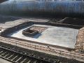
Construction already started.
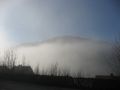
Fog in Neckarsteinach.
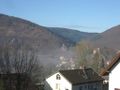
The four castles Neckarsteinach is famous for (one is behind the tree).
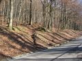
Shortcut.
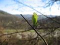
It felt like the first day of spring.
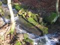
A creek between me and the hashpoint.
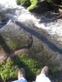
I crossed it with dry feet.
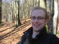
Obligatory.
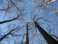
At the hashpoint, looking up.
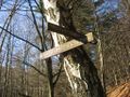
On the way back.


