Difference between revisions of "2011-01-15 39 -108"
From Geohashing
imported>Messyhair42 |
imported>FippeBot m (Location) |
||
| (7 intermediate revisions by 2 users not shown) | |||
| Line 18: | Line 18: | ||
== Photos == | == Photos == | ||
| − | |||
| − | |||
| − | |||
<gallery perrow="5"> | <gallery perrow="5"> | ||
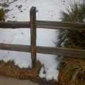
| + | Image:2011-01-15 14-34-01 744.jpg | necessary proof | ||
| + | Image:2011-01-15 14-32-46 549.jpg | the hashpoint | ||
</gallery> | </gallery> | ||
| − | + | [[Category:Expeditions]] | |
| − | + | [[Category:Expeditions with photos]] | |
[[Category:Coordinates reached]] | [[Category:Coordinates reached]] | ||
| − | + | {{location|US|CO|ME}} | |
Latest revision as of 05:14, 9 August 2019
| Sat 15 Jan 2011 in 39,-108: 39.0734244, -108.4637741 geohashing.info google osm bing/os kml crox |
Contents
Location
In a subdivision in Clifton, Colorado
Participants
Plans
Drive by on my way to work
Expedition
one end of the street was blocked off, so I had to go around (stealing my opportunity for a Tron achievement). realized I should have learned my new GPS unit completely before attempting to use it on an expedition.

