Difference between revisions of "2011-02-25 43 -88"
imported>Bassoon (Created page with "{{subst:Expedition |lat = 43 |lon = -88 |date = 2011-02-25 }}") |
imported>Bassoon |
||
| Line 1: | Line 1: | ||
| − | |||
| − | |||
| − | |||
| − | |||
| − | |||
| − | |||
| − | |||
| − | |||
| − | |||
| − | |||
{{meetup graticule | {{meetup graticule | ||
| lat=43 | | lat=43 | ||
| Line 15: | Line 5: | ||
}} | }} | ||
| − | |||
| − | |||
== Location == | == Location == | ||
| − | + | Middle of Balsam Drive, Menomonee Falls, Wisconsin. | |
== Participants == | == Participants == | ||
| − | + | *[[User:Bassoon|Bassoon]] | |
| + | *[[User:Dedehawk|Dedehawk]] | ||
| + | *Karen | ||
| + | *[[User:Kuderererer|Kuderererer]] | ||
| + | *[[User:The9thPatriarch|The9thPatriarch]] | ||
== Plans == | == Plans == | ||
| − | + | Basically, we were to walk to the hash and back. | |
== Expedition == | == Expedition == | ||
| − | + | After a long week, the gang decided to kick back and enjoy a nice evening at The9thPatriarch's house. After awhile, we got bored, so what do you do when you bored? You geohash! | |
| + | |||
| + | We checked the hash and found that the hash was close. Very close. In town, even. No, better. Across the street. Holy crap. | ||
| − | + | We began the intricate planning that was necessary to achieve this hash. Because it was so close, we could go all out and get some of the achievements that would be hard to do if the hash was farther away than across the street. | |
| − | + | ||
| + | In the end, we decided upon Walking Hash, No Batteries Geohash, and Tron Geohash. Overall, this would be pretty simple. | ||
| + | |||
| + | Because it was such a close hash, nothing too interesting happened, although it did start snowing halfway. Most of this hash was about getting the necessary proof for Tron and No Batteries. | ||
| + | |||
| + | For Tron, we've included a drawn map of our path, as well as a picture of each intersection sign that we turned at. You can follow our path on our provided map. | ||
| + | |||
| + | Similarly, on the map, we marked three driveways and two trees. These can be seen in four pictures taken at the hash. | ||
== Photos == | == Photos == | ||
| Line 37: | Line 38: | ||
--> | --> | ||
<gallery perrow="5"> | <gallery perrow="5"> | ||
| + | Image:2011-02-25 44 -88 plotting.JPG | We plot. | ||
| + | Image:2011-02-25 44 -88 moar.JPG | Bassoon draws up a map. | ||
| + | Image:2011-02-25 44 -88 map.JPG | Our map, with three driveways and two trees marked. | ||
| + | Image:2011-02-25 44 -88 cross-1.JPG | Intersection 1 | ||
| + | Image:2011-02-25 44 -88 cross-2.JPG | Intersection 2 | ||
| + | Image:2011-02-25 44 -88 cross-3.JPG | Intersection 3 | ||
| + | Image:2011-02-25 44 -88 cross-4.JPG | Intersection 4 | ||
| + | Image:2011-02-25 44 -88 cross-5.JPG | Intersection 5: Unreadable sign says Plaza | ||
| + | Image:2011-02-25 44 -88 veri-1.JPG | Tree 1 and Driveway 1. | ||
| + | Image:2011-02-25 44 -88 veri-2.JPG | Tree 2. | ||
| + | Image:2011-02-25 44 -88 veri-3.JPG | Driveway 2. | ||
| + | Image:12011-02-25 44 -88 veri-4.JPG | Driveway 3. | ||
| + | Image:2011-02-25 44 -88 groupshot.JPG.JPG | Awful groupshot because of snowpile. | ||
| + | Image:2011-02-25 44 -88 cross-6.JPG | Intersection 6: Unreadable sign says Balsam | ||
| + | Image:2011-02-25 44 -88 cross-7.JPG | Intersection 7 | ||
| + | Image:2011-02-25 44 -88 cross-8.JPG | Intersection 8 | ||
| + | Image:2011-02-25 44 -88 cross-9.JPG | Intersection 9 | ||
| + | Image:2011-02-25 44 -88 cross-10.JPG | Intersection 10: Home again! | ||
| + | Image:2011-02-25 44 -88 tronmap.JPG | Map for Tron. | ||
</gallery> | </gallery> | ||
== Achievements == | == Achievements == | ||
{{#vardefine:ribbonwidth|800px}} | {{#vardefine:ribbonwidth|800px}} | ||
| − | + | {{land geohash | |
| + | | latitude = 43 | ||
| + | | longitude = -88 | ||
| + | | date = 2011-02-25 | ||
| + | | name = Bassoon, Dedehawk, Karen, Kuderererer, and The9thPatriarch | ||
| + | | image = 2011-02-25 44 -88 groupshot.JPG.JPG | ||
| + | }} | ||
| + | {{drag-along | ||
| + | | latitude = 43 | ||
| + | | longitude = -88 | ||
| + | | date = 2011-02-25 | ||
| + | | partner = Karen | ||
| + | | name = Bassoon, Dedehawk, Kuderererer, and The 9th Patriarch | ||
| + | | image = 2011-02-25 44 -88 groupshot.JPG.JPG | ||
| + | }} | ||
| + | {{Walk geohash | ||
| + | | latitude = 43 | ||
| + | | longitude = -88 | ||
| + | | date = 2011-02-25 | ||
| + | | name = Bassoon, Dedehawk, Karen, Kuderererer, and The9thPatriarch | ||
| + | | distance = 1.029 miles | ||
| + | | image = 2011-02-25 44 -88 groupshot.JPG.JPG | ||
| + | }} | ||
| + | {{No_batteries_geohash | ||
| + | | latitude = 43 | ||
| + | | longitude = -88 | ||
| + | | date = 2011-02-25 | ||
| + | | name = Bassoon, Dedehawk, Karen, Kuderererer, and The9thPatriarch | ||
| + | | image = 2011-02-25 44 -88 map.JPG | ||
| + | }} | ||
| + | {{Tron | ||
| + | | latitude = 43 | ||
| + | | longitude = -88 | ||
| + | | date = 2011-02-25 | ||
| + | | tracklog = http://wiki.xkcd.com/geohashing/File:2011-02-25_44_-88_tronmap.JPG | ||
| + | | possessive = their | ||
| + | | name = Bassoon, Dedehawk, Karen, Kuderererer, and The9thPatriarch | ||
| + | | image = 2011-02-25 44 -88 cross-7.JPG | ||
| + | }} | ||
| + | {{Frozen Geohash | ||
| + | | latitude = 43 | ||
| + | | longitude = -88 | ||
| + | | date = 2011-02-25 | ||
| + | | temperature = -4°C | ||
| + | | name = Bassoon, Dedehawk, Karen, Kuderererer, and The9thPatriarch | ||
| + | | image = 2011-02-25 44 -88 groupshot.JPG.JPG | ||
| + | }} | ||
| − | |||
| − | |||
| − | |||
| − | |||
| − | |||
| − | |||
| − | |||
| − | |||
| − | |||
| − | |||
| − | |||
[[Category:Expeditions]] | [[Category:Expeditions]] | ||
| − | |||
[[Category:Expeditions with photos]] | [[Category:Expeditions with photos]] | ||
| − | + | ||
[[Category:Expedition without GPS]] | [[Category:Expedition without GPS]] | ||
| − | + | ||
| − | |||
| − | |||
[[Category:Coordinates reached]] | [[Category:Coordinates reached]] | ||
| − | |||
| − | |||
| − | |||
| − | |||
| − | |||
| − | |||
| − | |||
| − | |||
| − | |||
| − | |||
Revision as of 03:59, 26 February 2011
| Fri 25 Feb 2011 in 43,-88: 43.1148984, -88.1044767 geohashing.info google osm bing/os kml crox |
Location
Middle of Balsam Drive, Menomonee Falls, Wisconsin.
Participants
Plans
Basically, we were to walk to the hash and back.
Expedition
After a long week, the gang decided to kick back and enjoy a nice evening at The9thPatriarch's house. After awhile, we got bored, so what do you do when you bored? You geohash!
We checked the hash and found that the hash was close. Very close. In town, even. No, better. Across the street. Holy crap.
We began the intricate planning that was necessary to achieve this hash. Because it was so close, we could go all out and get some of the achievements that would be hard to do if the hash was farther away than across the street.
In the end, we decided upon Walking Hash, No Batteries Geohash, and Tron Geohash. Overall, this would be pretty simple.
Because it was such a close hash, nothing too interesting happened, although it did start snowing halfway. Most of this hash was about getting the necessary proof for Tron and No Batteries.
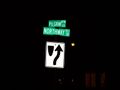
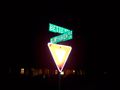
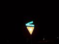
For Tron, we've included a drawn map of our path, as well as a picture of each intersection sign that we turned at. You can follow our path on our provided map.
Similarly, on the map, we marked three driveways and two trees. These can be seen in four pictures taken at the hash.
Photos
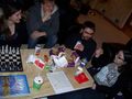
We plot.
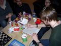
Bassoon draws up a map.
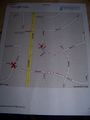
Our map, with three driveways and two trees marked.
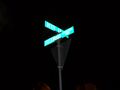
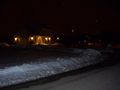
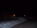
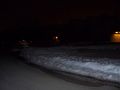
Intersection 1
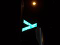
Intersection 2
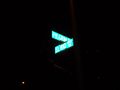
Intersection 3
Intersection 4
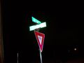
Intersection 5: Unreadable sign says Plaza
Tree 1 and Driveway 1.
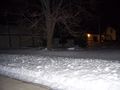
Tree 2.
Driveway 2.
Driveway 3.
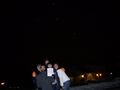
Awful groupshot because of snowpile.
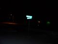
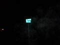
Intersection 6: Unreadable sign says Balsam
Intersection 7
Intersection 8
Intersection 9
Intersection 10: Home again!
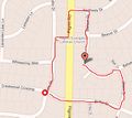
Map for Tron.


Achievements
Bassoon, Dedehawk, Karen, Kuderererer, and The9thPatriarch earned the Land geohash achievement
|
Bassoon, Dedehawk, Kuderererer, and The 9th Patriarch earned the Drag-along achievement
|
Bassoon, Dedehawk, Karen, Kuderererer, and The9thPatriarch earned the Walk geohash Achievement
|
Bassoon, Dedehawk, Karen, Kuderererer, and The9thPatriarch earned the No Batteries Geohash Achievement
|
Bassoon, Dedehawk, Karen, Kuderererer, and The9thPatriarch earned the Tron achievement
|
