Difference between revisions of "2011-04-03 35 -114"
imported>Wyle & RoadRunner |
imported>Wyle & RoadRunner |
||
| Line 21: | Line 21: | ||
which, by the way, is our 4th and possibly 5th (Nogales is still undecided) virgin graticule. Bring it on, XKCD. | which, by the way, is our 4th and possibly 5th (Nogales is still undecided) virgin graticule. Bring it on, XKCD. | ||
| − | PS. And HUGE kudos to RoadRunner who's foresight was ... "I know we don't need the GPS for the river, but bring it anyway." | + | == PS. And HUGE kudos to RoadRunner, who's foresight was ... "I know we don't need the GPS for the river, but bring it anyway." == |
<gallery widths="160px" align=center> | <gallery widths="160px" align=center> | ||
Image:2011-04-03_35_-114_gps.jpg|Bullhead City, Arizona | Image:2011-04-03_35_-114_gps.jpg|Bullhead City, Arizona | ||
Revision as of 05:00, 11 April 2011
| Sun 3 Apr 2011 in Bullhead City: 35.3724286, -114.2031979 geohashing.info google osm bing/os kml crox |
Contents
Location
South of Chloride, Az
Participants
Expeditions
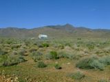
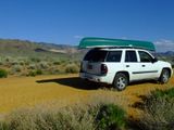
RoadRunner and I were on our way back to Tucson from a weekend canoeing trip down the Colorado River when we stopped at a roadside store for some yummy jerky (flavored dried meat) when we decided to check local geohash points. A quick U-turn had us heading back toward Chloride to find something Google labeled a road. We only had to get out and open two farm gates (with "please close gate" signs) along this "road". Eventually drove to within a hundred meters of the spot and a simple walk and GPS shuffle was all it took. Found a quicker way out through Chloride (new iPhone is really cool) and were back on the highway heading for home.
And since there's no other posting for this graticule, I guess this is ...
The Deflowering of the Bullhead City Graticule
Template:Virgin graticule which, by the way, is our 4th and possibly 5th (Nogales is still undecided) virgin graticule. Bring it on, XKCD.


