Difference between revisions of "2011-04-16 55 13"
From Geohashing
imported>Llavids (Created page with "{{meetup graticule | lat=55 | lon=13 | date=2011-04-16 }} __NOTOC__ == Location == Near Linderöd, Skåne, Sweden. == Participants ==...") |
imported>FippeBot m (Location) |
||
| (3 intermediate revisions by one other user not shown) | |||
| Line 42: | Line 42: | ||
{{consecutive geohash | {{consecutive geohash | ||
| − | | count = | + | | count = 4 |
| latitude = 55 | | latitude = 55 | ||
| − | | longitude = 13 | + | | longitude = 13 |
| date = 2011-04-13 | | date = 2011-04-13 | ||
| name = Llavids | | name = Llavids | ||
| + | }} | ||
| + | |||
| + | {{Ambassador geohash | ||
| + | | latitude = 55 | ||
| + | | longitude = 13 | ||
| + | | date = 2011-04-16 | ||
| + | | granter = unknown | ||
| + | | name = [[User:Llavids|Llavids]] | ||
}} | }} | ||
| Line 53: | Line 61: | ||
[[Category:Coordinates reached]] | [[Category:Coordinates reached]] | ||
[[Category:Sweden]] | [[Category:Sweden]] | ||
| + | {{location|SE|M}} | ||
Latest revision as of 06:11, 9 August 2019
| Sat 16 Apr 2011 in 55,13: 55.9341509, 13.7544222 geohashing.info google osm bing/os kml crox |
Location
Participants
Plans
20 minutes drive from home.
Expedition
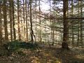
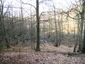
Drove to Linderöd and followed the road into the forest. When being 2,5 km from target the road ends up at a farmers house. The farmer was outside and I thought I could ask him for directions and permission. He told me it was alright to keep driving up his land and park about 800 meters from the geohashe. I drove into their forest and parked the car and took out the dog for a walk. Walked to the geohashe and documented the place. Luckily somebody was cutting down trees just 200 meters off, at a safe distance. Walked back and drove home.
Photos
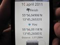
Proof
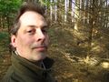
The grin
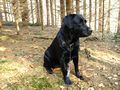
The dog
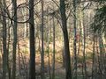
North
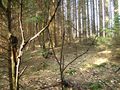
South
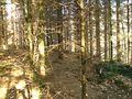
East
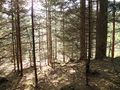
West
Cutting down trees
Swamp around the hill where the geohashe was
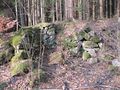
Ruins near parking


Achievements
Llavids earned the Land geohash achievement
|
Llavids earned the Consecutive geohash achievement
|
Llavids earned the Ambassador achievement
|