Difference between revisions of "2011-04-29 37 -76"
From Geohashing
imported>Bob0the0mighty m ([live] Made it to a point for the first time in over a year. Glad it was so close. Anyone else active in the area?) |
imported>Jiml m (Adjust result codes) |
||
| Line 1: | Line 1: | ||
| − | |||
<!-- If you did not specify these parameters in the template, please substitute appropriate values for IMAGE, LAT, LON, and DATE (YYYY-MM-DD format) | <!-- If you did not specify these parameters in the template, please substitute appropriate values for IMAGE, LAT, LON, and DATE (YYYY-MM-DD format) | ||
| Line 15: | Line 14: | ||
}} | }} | ||
| − | + | ||
__NOTOC__ | __NOTOC__ | ||
== Location == | == Location == | ||
<!-- where you've surveyed the hash to be --> | <!-- where you've surveyed the hash to be --> | ||
| + | Near Newport News | ||
== Participants == | == Participants == | ||
<!-- who attended --> | <!-- who attended --> | ||
| + | |||
| + | * [[User:Bob0the0mighty|Bob0the0mighty]] | ||
== Plans == | == Plans == | ||
<!-- what were the original plans --> | <!-- what were the original plans --> | ||
| + | Unknown | ||
== Expedition == | == Expedition == | ||
| Line 31: | Line 34: | ||
*Made it to a point for the first time in over a year. Glad it was so close. Anyone else active in the area? -- [[User:Bob0the0mighty|Bob0the0mighty]] [http://www.openstreetmap.org/?lat=37.05363958&lon=-76.39721362&zoom=16&layers=B000FTF @37.0536,-76.3972] 19:36, 29 April 2011 (EDT) | *Made it to a point for the first time in over a year. Glad it was so close. Anyone else active in the area? -- [[User:Bob0the0mighty|Bob0the0mighty]] [http://www.openstreetmap.org/?lat=37.05363958&lon=-76.39721362&zoom=16&layers=B000FTF @37.0536,-76.3972] 19:36, 29 April 2011 (EDT) | ||
| + | |||
| + | <!-- Nothing in this section for now> | ||
== Tracklog == | == Tracklog == | ||
<!-- if your GPS device keeps a log, you may post a link here --> | <!-- if your GPS device keeps a log, you may post a link here --> | ||
| Line 46: | Line 51: | ||
{{#vardefine:ribbonwidth|800px}} | {{#vardefine:ribbonwidth|800px}} | ||
<!-- Add any achievement ribbons you earned below, or remove this section --> | <!-- Add any achievement ribbons you earned below, or remove this section --> | ||
| + | |||
| + | |||
| + | * Land geohash | ||
| Line 52: | Line 60: | ||
[[Category:New report]] | [[Category:New report]] | ||
| − | |||
| − | |||
| − | |||
| − | |||
| − | |||
[[Category:Expeditions]] | [[Category:Expeditions]] | ||
| − | + | ||
[[Category:Expeditions with photos]] | [[Category:Expeditions with photos]] | ||
| − | |||
| − | |||
| − | |||
| − | |||
| − | |||
[[Category:Coordinates reached]] | [[Category:Coordinates reached]] | ||
| − | |||
| − | |||
| − | |||
| − | |||
| − | |||
| − | |||
| − | |||
| − | |||
| − | |||
| − | |||
Revision as of 01:17, 30 April 2011
| Fri 29 Apr 2011 in 37,-76: 37.0532816, -76.3973845 geohashing.info google osm bing/os kml crox |
Location
Near Newport News
Participants
Plans
Unknown
Expedition
- Made it to a point for the first time in over a year. Glad it was so close. Anyone else active in the area? -- Bob0the0mighty @37.0536,-76.3972 19:36, 29 April 2011 (EDT)
Photos
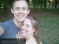
Success again finally. Also upside down @37.0533,-76.3974

Achievements
- Land geohash