Difference between revisions of "2011-08-19 51 11"
imported>Reinhard m (wrong grat) |
imported>Reinhard (report) |
||
| Line 14: | Line 14: | ||
== Expedition == | == Expedition == | ||
| − | + | After a rainy day in Jena, the sun finally came out few hours before sunset and Manu felt like doing a two-hour cycling trip and could convice Reinhard to accompany her (Truly, that's how it went!). While watching out for some unexplored bikeways, they got to Eberstedt, from where a dirty field path was leading uphill and as close as 160 m to the hashpoint. The remaining distance was even easier to cycle on a tractor lane into a recently harvested field with lots of bales of straw, which appeared in a beautiful golden color shade in the golden setting sun. After showing the borrowed sheep the hash surroundings, they went on to Auerstedt, where they found a nice bikeway to Bad Sulza and got back to Cospeda, already in the dark. | |
== Photos == | == Photos == | ||
| − | {{gallery|width=200|height=200|lines= | + | {{gallery|width=200|height=200|lines=2 |
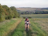
|Image:20110819-51N11E-01.jpg|The field path from Eberstedt. | |Image:20110819-51N11E-01.jpg|The field path from Eberstedt. | ||
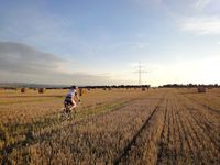
|Image:20110819-51N11E-02.jpg|BFX-Manu. (bicycle field crossing) | |Image:20110819-51N11E-02.jpg|BFX-Manu. (bicycle field crossing) | ||
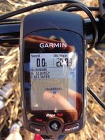
|Image:20110819-51N11E-03.jpg|Coordinates reached. | |Image:20110819-51N11E-03.jpg|Coordinates reached. | ||
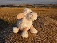
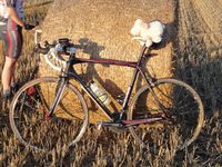
| − | |Image:20110819-51N11E-04.jpg|The sheep on a rolling cow. | + | |Image:20110819-51N11E-04.jpg|The sheep on a rolling cow (Rollkuh aka Strohballen (bale of straw)). |
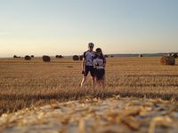
|Image:20110819-51N11E-05.jpg|Reinhard, sheep and Manu at the hashpoint. | |Image:20110819-51N11E-05.jpg|Reinhard, sheep and Manu at the hashpoint. | ||
|Image:20110819-51N11E-06.jpg|It cycled all the way with Reinhard in the backpack (not shown). | |Image:20110819-51N11E-06.jpg|It cycled all the way with Reinhard in the backpack (not shown). | ||
Revision as of 12:41, 20 August 2011
| Fri 19 Aug 2011 in 51,11: 51.0815676, 11.5611858 geohashing.info google osm bing/os kml crox |
Location
On a harvested field near Auerstedt in Thuringia.
Participants
Expedition
After a rainy day in Jena, the sun finally came out few hours before sunset and Manu felt like doing a two-hour cycling trip and could convice Reinhard to accompany her (Truly, that's how it went!). While watching out for some unexplored bikeways, they got to Eberstedt, from where a dirty field path was leading uphill and as close as 160 m to the hashpoint. The remaining distance was even easier to cycle on a tractor lane into a recently harvested field with lots of bales of straw, which appeared in a beautiful golden color shade in the golden setting sun. After showing the borrowed sheep the hash surroundings, they went on to Auerstedt, where they found a nice bikeway to Bad Sulza and got back to Cospeda, already in the dark.
Photos
|
