Difference between revisions of "2011-09-11 48 11"
imported>Gefrierbrand |
imported>FippeBot m (Location) |
||
| (7 intermediate revisions by 2 users not shown) | |||
| Line 14: | Line 14: | ||
}} | }} | ||
| − | + | ||
__NOTOC__ | __NOTOC__ | ||
== Location == | == Location == | ||
| − | + | ||
| + | |||
Middle of a already harvested field near a graveyard in Langengeisling (north of Erding, home of the famous beer). | Middle of a already harvested field near a graveyard in Langengeisling (north of Erding, home of the famous beer). | ||
| Line 24: | Line 25: | ||
== Plans == | == Plans == | ||
| − | + | ||
| − | This was the fun part. I did not plan geohashing that day at all. I was already going to bed and attempted to set my alarm clock on my Smartphone. I have no homescreen icon for the clock yet, but geohashdroid has one. So I more or less accidentally clicked the geohashing Icon in a "what could it hurt, it's going to be miles away anyway" fashion just to get surprised the current point was only about 2 km in distance from my current location. | + | This was the fun part. I did not plan geohashing that day at all. I was already going to bed and attempted to set my alarm clock on my Smartphone. I have no homescreen icon for the clock yet, but geohashdroid has one. |
| + | |||
| + | So I more or less accidentally clicked the geohashing Icon in a "what could it hurt, it's going to be miles away anyway" fashion just to get surprised the current point was only about 2 km in distance from my current location. | ||
| + | |||
I realized it was already almost half past eleven and therefore the perfect opportunity for a midnight geohash! Screw sleeping! | I realized it was already almost half past eleven and therefore the perfect opportunity for a midnight geohash! Screw sleeping! | ||
== Expedition == | == Expedition == | ||
| − | |||
| − | |||
| − | I had already traveled about a mile as I realized I had not taken any camera besides my cellphone which was also serving | + | Luckily, I still had my pants on and only needed to grab a few things and I headed straight to my car. (Yes, the hash was more or less in walking distance, but I suddenly felt the need to go eat something afterwards which is tricky in the middle of the night and I had to travel quite a lot further to the next open restaurant.) |
| + | |||
| + | I had already traveled about a mile as I realized I had not taken any camera besides my cellphone which was also serving as my GPS device. So there was no way to take a picture of it at the location. Luckily, it's capable of recording GPS tracks, which are just as good. Therefore the track starts in the middle of nowhere. (Guess at which restaurant it ends :D) | ||
The way to the designated location was basically very uneventful. I had to take a few U-Turns due to closed roads and walk the last 200 meters as cars were not allowed any further. | The way to the designated location was basically very uneventful. I had to take a few U-Turns due to closed roads and walk the last 200 meters as cars were not allowed any further. | ||
| − | I encountered another not yet harvested corn field just like in my last Expedition, but to my pleasure, the hash was located on the other side of the road in a field, which had some sort of clearly already harvested but still standing plants on it. | + | I encountered another not yet harvested corn field just like the one in my last Expedition, |
| + | but to my pleasure, the hash was located on the other side of the road in a field, which | ||
| + | had some sort of clearly already harvested but still standing plants on it. This stubble | ||
| + | where about half a meter high and quite sharp at the edges, but walking through them was | ||
| + | still a lot easier than to advance through 3-4 meter high corn. | ||
| − | I had to run around the field quite a lot to get as close as possible to the Geohash, as the GPS signal was very weak. I suppose it was set to lower accuracy on purpose due to the date, but it might also have been disturbed by the nearby airport radars and so on. | + | I had to run around the field quite a lot to get as close as possible to the Geohash, |
| + | as the GPS signal was very weak. I suppose it was set to lower accuracy on purpose | ||
| + | due to the date, but it might also have been disturbed by the nearby airport radars | ||
| + | and so on. | ||
Almost dead on at midnight, I got as close as 3m to the point! | Almost dead on at midnight, I got as close as 3m to the point! | ||
| + | |||
== Tracklog == | == Tracklog == | ||
| − | + | [http://neff.alfahosting.org/publicstuff/2011-09-11%202340.gpx Here you go] | |
| − | |||
== Photos == | == Photos == | ||
| − | + | ||
| − | |||
| − | |||
<gallery perrow="5"> | <gallery perrow="5"> | ||
| − | File:Hash reached.jpg| Picture taken aiming somewhere near myself and the ground at the | + | File:2011-09-11 23.48.21-1-.jpg | Again another corn field |
| + | File:2011-09-11 23.51.40-1-.jpg | No idea what these plants once were, but their stubbles are not comfortable to walk trough | ||
| + | File:Hash reached.jpg| Picture taken aiming somewhere near myself and the ground at the hash location | ||
| + | File:2011-09-12 00.03.19-1-.jpg | Even if this picture looks like nothing, this was a graveyard right next to the hash. The flickering lights were kind of creepy and kind of cool. | ||
</gallery> | </gallery> | ||
| − | |||
== Achievements == | == Achievements == | ||
{{#vardefine:ribbonwidth|800px}} | {{#vardefine:ribbonwidth|800px}} | ||
| − | + | {{land geohash | |
| − | + | | latitude = 48 | |
| + | | longitude = 11 | ||
| + | | date = 2011-09-11 | ||
| + | | name = Gefrierbrand | ||
| + | }} | ||
| + | {{Midnight geohash | ||
| + | | latitude = 48 | ||
| + | | longitude = 11 | ||
| + | | date = 2011-09-11 | ||
| + | | name = Gefrierbrand | ||
| + | }} | ||
| + | |||
| + | |||
| − | |||
| − | |||
| − | |||
[[Category:Expeditions]] | [[Category:Expeditions]] | ||
[[Category:Expeditions with photos]] | [[Category:Expeditions with photos]] | ||
[[Category:Coordinates reached]] | [[Category:Coordinates reached]] | ||
| + | {{location|DE|BY|ED}} | ||
Latest revision as of 00:47, 13 August 2019
| Sun 11 Sep 2011 in 48,11: 48.3321399, 11.9189641 geohashing.info google osm bing/os kml crox |
Location
Middle of a already harvested field near a graveyard in Langengeisling (north of Erding, home of the famous beer).
Participants
Plans
This was the fun part. I did not plan geohashing that day at all. I was already going to bed and attempted to set my alarm clock on my Smartphone. I have no homescreen icon for the clock yet, but geohashdroid has one.
So I more or less accidentally clicked the geohashing Icon in a "what could it hurt, it's going to be miles away anyway" fashion just to get surprised the current point was only about 2 km in distance from my current location.
I realized it was already almost half past eleven and therefore the perfect opportunity for a midnight geohash! Screw sleeping!
Expedition
Luckily, I still had my pants on and only needed to grab a few things and I headed straight to my car. (Yes, the hash was more or less in walking distance, but I suddenly felt the need to go eat something afterwards which is tricky in the middle of the night and I had to travel quite a lot further to the next open restaurant.)
I had already traveled about a mile as I realized I had not taken any camera besides my cellphone which was also serving as my GPS device. So there was no way to take a picture of it at the location. Luckily, it's capable of recording GPS tracks, which are just as good. Therefore the track starts in the middle of nowhere. (Guess at which restaurant it ends :D)
The way to the designated location was basically very uneventful. I had to take a few U-Turns due to closed roads and walk the last 200 meters as cars were not allowed any further.
I encountered another not yet harvested corn field just like the one in my last Expedition, but to my pleasure, the hash was located on the other side of the road in a field, which had some sort of clearly already harvested but still standing plants on it. This stubble where about half a meter high and quite sharp at the edges, but walking through them was still a lot easier than to advance through 3-4 meter high corn.
I had to run around the field quite a lot to get as close as possible to the Geohash, as the GPS signal was very weak. I suppose it was set to lower accuracy on purpose due to the date, but it might also have been disturbed by the nearby airport radars and so on.
Almost dead on at midnight, I got as close as 3m to the point!
Tracklog
Photos
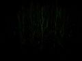
Again another corn field
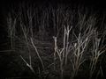
No idea what these plants once were, but their stubbles are not comfortable to walk trough
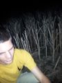
Picture taken aiming somewhere near myself and the ground at the hash location

Even if this picture looks like nothing, this was a graveyard right next to the hash. The flickering lights were kind of creepy and kind of cool.


Achievements
Gefrierbrand earned the Land geohash achievement
|
Gefrierbrand earned the Midnight Geohash achievement
|