Difference between revisions of "2011-10-01 48 9"
From Geohashing
imported>Ekorren (creating page) |
imported>FippeBot m (Location) |
||
| (One intermediate revision by one other user not shown) | |||
| Line 18: | Line 18: | ||
== Gallery == | == Gallery == | ||
<gallery> | <gallery> | ||
| + | File:2011-10-01_48_9_Train.JPG|Train at final station Oberlenningen | ||
| + | File:2011-10-01_48_9_Bus_Trailer.JPG|The lazy way up the mountains | ||
| + | File:2011-10-01_48_9_Rocks.JPG|Random Rock Impression | ||
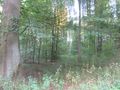
| + | File:2011-10-01_48_9_Moor_Way.JPG|Schopfloch Moor impressions | ||
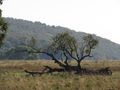
| + | File:2011-10-01_48_9_Moor_Tree.JPG| | ||
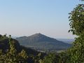
| + | File:2011-10-01_48_9_View_1.JPG|View down from the mountain ridge | ||
| + | File:2011-10-01_48_9_View_2.JPG| | ||
| + | File:2011-10-01_48_9_Steige.JPG|My way back down (looked more impressing in reality) | ||
| + | File:2011-10-01_48_9_Castle.JPG|Some castle somewhere | ||
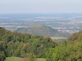
| + | File:2011-10-01_48_9_View_3.JPG|Another view down | ||
| + | File:2011-10-01_48_9_Dinosaur.JPG|They are behind the fence. We are safe. | ||
| + | File:2011-10-01_48_9_TentacleMonster.JPG|But this one is going to eat you! | ||
| + | File:2011-10-01_48_9_SignBergwaldweg.JPG|If you are on just a small hill surrounded by high mountains, you wouldn't expect the place being called "mountain forest" | ||
| + | File:2011-10-01_48_9_Hashpoint.JPG|The hashpoint | ||
| + | File:2011-10-01_48_9_GPS.JPG|Coordinates reached | ||
</gallery> | </gallery> | ||
| Line 24: | Line 39: | ||
[[Category:Expeditions with photos]] | [[Category:Expeditions with photos]] | ||
[[Category:Coordinates reached]] | [[Category:Coordinates reached]] | ||
| + | {{location|DE|BW|ES}} | ||
Latest revision as of 01:05, 13 August 2019
| Sat 1 Oct 2011 in 48,9: 48.6414014, 9.5396268 geohashing.info google osm bing/os kml crox |
Contents
Location
Holzmaden, a piece of forest.
Participants
Ekorren explored a part of the Schwäbische Alb and then went to the hash.
Expedition
Gallery
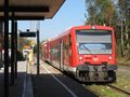
Train at final station Oberlenningen

The lazy way up the mountains
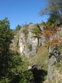
Random Rock Impression
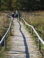
Schopfloch Moor impressions
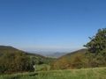
View down from the mountain ridge
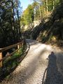
My way back down (looked more impressing in reality)
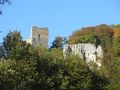
Some castle somewhere
Another view down
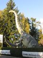
They are behind the fence. We are safe.

But this one is going to eat you!
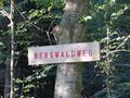
If you are on just a small hill surrounded by high mountains, you wouldn't expect the place being called "mountain forest"
The hashpoint

Coordinates reached


