Difference between revisions of "2011-12-19 55 13"
From Geohashing
imported>Llavids (Created page with "{{meetup graticule | lat=55 | lon=13 | date=2011-12-19 }} __NOTOC__ == Location == Östra Strö, Eslöv, Skåne, [[wikipedia:Sweden|Sw...") |
imported>FippeBot m (Location) |
||
| (2 intermediate revisions by one other user not shown) | |||
| Line 21: | Line 21: | ||
<gallery perrow="4"> | <gallery perrow="4"> | ||
| − | Image:20111219-55-13-01-Not-there. | + | Image:20111219-55-13-01-Not-there.jpg|Not closer |
</gallery> | </gallery> | ||
| Line 30: | Line 30: | ||
[[Category:Expeditions with photos]] | [[Category:Expeditions with photos]] | ||
[[Category:Coordinates not reached]] | [[Category:Coordinates not reached]] | ||
| − | [[Category:Not reached - | + | [[Category:Not reached - Mother Nature]] |
[[Category:Sweden]] | [[Category:Sweden]] | ||
| + | {{location|SE|M}} | ||
Latest revision as of 01:47, 13 August 2019
| Mon 19 Dec 2011 in 55,13: 55.8138359, 13.4271281 geohashing.info google osm bing/os kml crox |
Location
Östra Strö, Eslöv, Skåne, Sweden.
Participants
Plans
Since it was only 3 kilometers from home, but in a field I didn't think much of it. But eventually I had time to drive by.
Expedition
At late evening I got round to go there by car, and as I suspected it was about 320 meters into a muddy field. Had it been 400 meters to the east or west, it would have been more accessible, but not now. Just took a single photo from the car while point the headlights in the right direction.
Photos
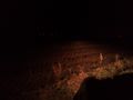
Not closer
