Difference between revisions of "2012-02-21 50 4"
From Geohashing
imported>Tyros (An expedition message sent via Geohash Droid for Android.) |
imported>FippeBot m (Location) |
||
| (9 intermediate revisions by 2 users not shown) | |||
| Line 1: | Line 1: | ||
| − | |||
| − | |||
| − | |||
| − | |||
| − | |||
| − | |||
| − | |||
| − | |||
| − | |||
| − | |||
{{meetup graticule | {{meetup graticule | ||
| lat=50 | | lat=50 | ||
| Line 18: | Line 8: | ||
__NOTOC__ | __NOTOC__ | ||
== Location == | == Location == | ||
| − | + | In an open field near Hoegaarden. | |
== Participants == | == Participants == | ||
<!-- who attended --> | <!-- who attended --> | ||
| + | [[User:Tyros|Tyros]] | ||
== Plans == | == Plans == | ||
| Line 27: | Line 18: | ||
== Expedition == | == Expedition == | ||
| − | + | My second geohash in two days! Hoegaarden a village which is famous for the white beer with the same name. A few years ago, Inbev tried to close the local brewery, and tried to brew the beer elsewhere. But thy didn't succeed and had to reopen the local brewery. | |
== Tracklog == | == Tracklog == | ||
| Line 37: | Line 28: | ||
--> | --> | ||
<gallery perrow="5"> | <gallery perrow="5"> | ||
| + | |||
| + | Image:2012-02-21_50_4_21-58-40-601.jpg | Today | ||
| + | |||
| + | Image:2012-02-21_50_4_22-02-23-626.jpg | Oops. Max speed in Belgium is 120 km/h... | ||
| + | |||
| + | Image:2012-02-21_50_4_22-03-26-110.jpg | Hoegaarden church | ||
| + | |||
| + | Image:2012-02-21_50_4_22-04-17-599.jpg | | ||
</gallery> | </gallery> | ||
| Line 43: | Line 42: | ||
<!-- Add any achievement ribbons you earned below, or remove this section --> | <!-- Add any achievement ribbons you earned below, or remove this section --> | ||
| − | |||
| − | |||
| − | |||
| − | |||
| − | |||
| − | |||
| − | |||
| − | |||
| − | |||
| − | |||
| − | |||
[[Category:Expeditions]] | [[Category:Expeditions]] | ||
| − | |||
[[Category:Expeditions with photos]] | [[Category:Expeditions with photos]] | ||
| − | |||
| − | |||
| − | |||
| − | |||
| − | |||
[[Category:Coordinates reached]] | [[Category:Coordinates reached]] | ||
| − | + | {{location|BE|VBR}} | |
| − | |||
| − | |||
| − | |||
| − | |||
| − | |||
| − | |||
| − | |||
| − | |||
| − | |||
Latest revision as of 02:28, 13 August 2019
| Tue 21 Feb 2012 in 50,4: 50.7808811, 4.8922065 geohashing.info google osm bing/os kml crox |
Location
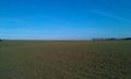
In an open field near Hoegaarden.
Participants
Plans
Expedition
My second geohash in two days! Hoegaarden a village which is famous for the white beer with the same name. A few years ago, Inbev tried to close the local brewery, and tried to brew the beer elsewhere. But thy didn't succeed and had to reopen the local brewery.
Tracklog
Photos
Today
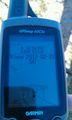
Oops. Max speed in Belgium is 120 km/h...
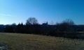
Hoegaarden church