Difference between revisions of "2012-02-22 49 9"
imported>Lovertux (An expedition message sent via Geohash Droid for Android.) |
imported>FippeBot m (Location) |
||
| (7 intermediate revisions by 2 users not shown) | |||
| Line 1: | Line 1: | ||
| − | |||
| − | |||
| − | |||
| − | |||
| − | |||
| − | |||
| − | |||
| − | |||
| − | |||
| − | |||
{{meetup graticule | {{meetup graticule | ||
| lat=49 | | lat=49 | ||
| Line 18: | Line 8: | ||
__NOTOC__ | __NOTOC__ | ||
== Location == | == Location == | ||
| − | + | A cabbage field near "Massenbach" | |
== Participants == | == Participants == | ||
| − | + | * [[User:Lovertux|Lovertux]] | |
== Plans == | == Plans == | ||
| − | + | I planned this to be my very first Geohash. Monitored the hashes for a while but no luck so far. Either much too far away or no time at hand to go there. In the morning I checked again and it looked very promising. I instantly got rather excited. So I made the decision to go for it after work. I wanted to start the small hike at around 5 p.m. | |
== Expedition == | == Expedition == | ||
| − | + | Unfortunately the start was not too good. I got delayed by some stupid stuff at work and left way past 5 p.m. and it was still a 40minuteish drive to the trailhead. I fired up Google Maps and let it route me to the location. But this incapable idiot kind of navigation software let me to a point over 2 km away from the actual position claiming that I should take the track which was closed for car traffic. Damn! It was getting dark already. So what to do? Accept the challenge and walk or relocate the car again to some point closer. | |
| + | |||
| + | I chickened out and relocated the car. From the new trailhead it was around 900m to the hash. Mainly on paved tracks. To make things more interesting I decided to use a side track. Not a wise decision. Although looking quite reasonable the track turned out to be rather muddy due to the recent snow which now had melted. Damn my boots were already spoilt and I was not even near the position. Following the path was rather annoying so I decided to bushwhack a bit. Because of the absence of bushes it was rather some meadow-whacking :-). This worked great and I started to enjoy this crazy activity. Finally the position was a cabbage kind of field. The view was nice if you are into fields. Unfortunately the photos do not do it any justice. | ||
| + | |||
| + | So this was my first Geohash. What are my insights of this newbie adventure? | ||
| + | # Colleagues are morons which are only getting in the way of things that are really fun | ||
| + | # Google navigation needs some serious improvement in our area. They just do not take geohashing into account. I will fall back to my Garmin with OSM maps. | ||
| + | # The thing is muddier than geocaching. | ||
| + | # It is more fun than I had expected to walk to some random coordinates in the middle of nowhere, a location with apparently not much to see than some frozen cabbage. | ||
| − | + | I guess you will read more of me in the future. | |
| − | |||
== Photos == | == Photos == | ||
| − | |||
| − | |||
| − | |||
<gallery perrow="5"> | <gallery perrow="5"> | ||
| + | Image:2012-02-22_49_9_18-13-24-577.jpg | Cabbage field near Massenbach [http://www.openstreetmap.org/?lat=49.16416478&lon=9.08373518&zoom=16&layers=B000FTF @49.1642,9.0837] | ||
| + | Image:2012-02-22_49_9_18-14-31-626.jpg | [http://www.openstreetmap.org/?lat=49.16416478&lon=9.08373518&zoom=16&layers=B000FTF @49.1642,9.0837] | ||
</gallery> | </gallery> | ||
== Achievements == | == Achievements == | ||
{{#vardefine:ribbonwidth|800px}} | {{#vardefine:ribbonwidth|800px}} | ||
| − | + | * Land | |
| − | |||
| − | |||
| − | |||
| − | |||
| − | |||
| − | |||
| − | |||
| − | |||
| − | |||
| − | |||
| − | |||
[[Category:Expeditions]] | [[Category:Expeditions]] | ||
| − | |||
[[Category:Expeditions with photos]] | [[Category:Expeditions with photos]] | ||
| − | |||
| − | |||
| − | |||
| − | |||
| − | |||
[[Category:Coordinates reached]] | [[Category:Coordinates reached]] | ||
| − | + | {{location|DE|BW|HN}} | |
| − | |||
| − | |||
| − | |||
| − | |||
| − | |||
| − | |||
| − | |||
| − | |||
| − | |||
Latest revision as of 02:28, 13 August 2019
| Wed 22 Feb 2012 in 49,9: 49.1641560, 9.0837553 geohashing.info google osm bing/os kml crox |
Location
A cabbage field near "Massenbach"
Participants
Plans
I planned this to be my very first Geohash. Monitored the hashes for a while but no luck so far. Either much too far away or no time at hand to go there. In the morning I checked again and it looked very promising. I instantly got rather excited. So I made the decision to go for it after work. I wanted to start the small hike at around 5 p.m.
Expedition
Unfortunately the start was not too good. I got delayed by some stupid stuff at work and left way past 5 p.m. and it was still a 40minuteish drive to the trailhead. I fired up Google Maps and let it route me to the location. But this incapable idiot kind of navigation software let me to a point over 2 km away from the actual position claiming that I should take the track which was closed for car traffic. Damn! It was getting dark already. So what to do? Accept the challenge and walk or relocate the car again to some point closer.
I chickened out and relocated the car. From the new trailhead it was around 900m to the hash. Mainly on paved tracks. To make things more interesting I decided to use a side track. Not a wise decision. Although looking quite reasonable the track turned out to be rather muddy due to the recent snow which now had melted. Damn my boots were already spoilt and I was not even near the position. Following the path was rather annoying so I decided to bushwhack a bit. Because of the absence of bushes it was rather some meadow-whacking :-). This worked great and I started to enjoy this crazy activity. Finally the position was a cabbage kind of field. The view was nice if you are into fields. Unfortunately the photos do not do it any justice.
So this was my first Geohash. What are my insights of this newbie adventure?
- Colleagues are morons which are only getting in the way of things that are really fun
- Google navigation needs some serious improvement in our area. They just do not take geohashing into account. I will fall back to my Garmin with OSM maps.
- The thing is muddier than geocaching.
- It is more fun than I had expected to walk to some random coordinates in the middle of nowhere, a location with apparently not much to see than some frozen cabbage.
I guess you will read more of me in the future.
Photos
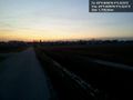
Cabbage field near Massenbach @49.1642,9.0837


Achievements
- Land