Difference between revisions of "2012-02-25 59 17"
imported>Cjk ([live picture] [http://www.openstreetmap.org/?lat=59.55955239&lon=17.35021519&zoom=16&layers=B000FTF @59.5596,17.3502]) |
imported>FippeBot m (Location) |
||
| (8 intermediate revisions by one other user not shown) | |||
| Line 1: | Line 1: | ||
| + | [[Image:{{{image|2012-02-25_59_17_10-09-00-901.jpg}}}|thumb|left]] | ||
| − | |||
| − | |||
| − | |||
| − | |||
| − | |||
| − | |||
| − | |||
| − | |||
| − | |||
{{meetup graticule | {{meetup graticule | ||
| lat=59 | | lat=59 | ||
| Line 19: | Line 11: | ||
== Location == | == Location == | ||
<!-- where you've surveyed the hash to be --> | <!-- where you've surveyed the hash to be --> | ||
| + | In a horse paddock between Hummelsta and Hacksta. | ||
== Participants == | == Participants == | ||
<!-- who attended --> | <!-- who attended --> | ||
| + | *[[User:Cjk|Carl-Johan]] | ||
== Plans == | == Plans == | ||
<!-- what were the original plans --> | <!-- what were the original plans --> | ||
| + | I woke up too early so a quick drive out towards Enköping would be nice. | ||
== Expedition == | == Expedition == | ||
<!-- how it all turned out. your narrative goes here. --> | <!-- how it all turned out. your narrative goes here. --> | ||
| + | I woke way to early, but I wasn't ready for a sunrise hash cause I was doing other stuff. But by 0830 I was ready to leave. Walked to the car and drove onto E18 almost all the way to Enköping. Then headed south. Close to the hash Google Navigation led me onto a gravel road. It was almost flooded at one place, and came past some castle looking house on the left close to the water. Snapped a nice picture of the trees. It looked like a painting by [http://www.lalouver.com/html/hockney_07/hockney15.html David Hockney]. | ||
| + | |||
| + | [[Image:2012-02-25_59_17_12-10-23-812.jpg|200px]] | ||
| + | |||
| + | Then google told me to take a right, and the road got worse. And as it turned south it got really bad, you almost needed a tractor to use this "road". Found the farm that was closest to the hash and parked the car. I could see a lot of horse paddocks and I was hoping it was in a normal field and not a paddock. Couldn't see any people around to ask for permission, just some horses. I walked closer outside the paddocks and as I got really close there was one that was open so I walked inside. Found the hash pretty much smack in the middle of this paddock. Marked a tiny Orange™ marker as to not disturb too much and snapped some pics. | ||
| + | |||
| + | [[Image:2012-02-25_59_17_10-09-30-841.jpg|800px]] | ||
| + | |||
| + | *Yet another horse paddock -- [[User:Cjk|Carl-Johan]] [http://www.openstreetmap.org/?lat=59.55949393&lon=17.35008242&zoom=16&layers=B000FTF @59.5595,17.3501] 10:03, 25 February 2012 (CET) | ||
| + | |||
| + | I walked back towards the stables and there I met a woman named Anki who wondered who I was. I said I was from the internet and explained about geohashing. She couldn't really understand why anyone would do that but wished me, "Good Luck!". Ambassador after the fact. | ||
| + | Took a better road back towards the E18, not the crazy path only good for tractors and went and had some food at Max and bought a frying pan at Barkaby. Then off home. | ||
| − | |||
== Tracklog == | == Tracklog == | ||
<!-- if your GPS device keeps a log, you may post a link here --> | <!-- if your GPS device keeps a log, you may post a link here --> | ||
| + | [http://maps.google.com/maps/ms?msa=0&msid=209560846421673743077.0004b9c7d089f1ccf5365 map]. | ||
== Photos == | == Photos == | ||
| Line 40: | Line 47: | ||
<gallery perrow="5"> | <gallery perrow="5"> | ||
| − | Image:2012-02- | + | Image:2012-02-25_59_17_12-10-23-812.jpg | Trees [http://www.openstreetmap.org/?lat=59.57160000&lon=17.37890000&zoom=16&layers=B000FTF @59.5716,17.3789] |
| + | |||
| + | Image:2012-02-25_59_17_12-11-07-622.jpg | Road getting sketchy [http://www.openstreetmap.org/?lat=59.56670000&lon=17.37080000&zoom=16&layers=B000FTF @59.5667,17.3708] | ||
| − | Image:2012-02- | + | Image:2012-02-25_59_17_12-11-57-220.jpg | Damn you Google Navigate! This isn't a road. [http://www.openstreetmap.org/?lat=59.56560000&lon=17.35590000&zoom=16&layers=B000FTF @59.5656,17.3559] |
| − | Image:2012-02- | + | Image:2012-02-25_59_17_12-12-23-545.jpg | House for sale [http://www.openstreetmap.org/?lat=59.56180000&lon=17.35140000&zoom=16&layers=B000FTF @59.5618,17.3514] |
| − | Image:2012-02-25_59_17_10-09-30-841.jpg | | + | Image:2012-02-25_59_17_15-49-06-804.jpg | Stables [http://www.openstreetmap.org/?lat=59.56180000&lon=17.35140000&zoom=16&layers=B000FTF @59.5618,17.3514] |
| + | |||
| + | Image:2012-02-25_59_17_12-12-43-894.jpg | Horses [http://www.openstreetmap.org/?lat=59.56080000&lon=17.35090000&zoom=16&layers=B000FTF @59.5608,17.3509] | ||
| + | |||
| + | Image:2012-02-25_59_17_10-08-13-687.jpg | Tiny marker [http://www.openstreetmap.org/?lat=59.55950000&lon=17.35000000&zoom=16&layers=B000FTF @59.5595,17.3500] | ||
| + | |||
| + | Image:2012-02-25_59_17_10-09-00-901.jpg | Grin [http://www.openstreetmap.org/?lat=59.55950000&lon=17.35000000&zoom=16&layers=B000FTF @59.5595,17.3500] | ||
| + | |||
| + | Image:2012-02-25_59_17_10-09-16-719.jpg | Panorama 1 [http://www.openstreetmap.org/?lat=59.55955239&lon=17.35021519&zoom=16&layers=B000FTF @59.5596,17.3502] | ||
| + | |||
| + | Image:2012-02-25_59_17_10-09-30-841.jpg | Panorama 2 [http://www.openstreetmap.org/?lat=59.55955239&lon=17.35021519&zoom=16&layers=B000FTF @59.5596,17.3502] | ||
</gallery> | </gallery> | ||
| Line 52: | Line 71: | ||
{{#vardefine:ribbonwidth|800px}} | {{#vardefine:ribbonwidth|800px}} | ||
<!-- Add any achievement ribbons you earned below, or remove this section --> | <!-- Add any achievement ribbons you earned below, or remove this section --> | ||
| + | {{land geohash | latitude = 59 | longitude = 17 | date = 2012-02-25 | name = [[User:Cjk|Carl-Johan]] }} | ||
| + | {{Ambassador geohash | latitude = 59 | longitude = 17 | date = 2012-02-25 | name = [[User:Cjk|Carl-Johan]] | granter = Anki }} | ||
<!-- =============== USEFUL CATEGORIES FOLLOW ================ | <!-- =============== USEFUL CATEGORIES FOLLOW ================ | ||
Delete the next line ONLY if you have chosen the appropriate categories below. If you are unsure, don't worry. People will read your report and help you with the classification. --> | Delete the next line ONLY if you have chosen the appropriate categories below. If you are unsure, don't worry. People will read your report and help you with the classification. --> | ||
| − | |||
<!-- Potential categories. Please include all the ones appropriate to your expedition --> | <!-- Potential categories. Please include all the ones appropriate to your expedition --> | ||
| Line 70: | Line 90: | ||
[[Category:Expedition without GPS]] | [[Category:Expedition without GPS]] | ||
--> | --> | ||
| + | [[Category:Expeditions]] | ||
| + | [[Category:Expeditions with photos]] | ||
| + | [[Category:Coordinates reached]] | ||
<!-- if you reached your coords: | <!-- if you reached your coords: | ||
| Line 83: | Line 106: | ||
[[Category:Not reached - Did not attempt]] when you went to an alternate location, or decided early on to abort the expedition. | [[Category:Not reached - Did not attempt]] when you went to an alternate location, or decided early on to abort the expedition. | ||
--> | --> | ||
| + | {{location|SE|C}} | ||
Latest revision as of 02:32, 13 August 2019

| Sat 25 Feb 2012 in 59,17: 59.5595027, 17.3500502 geohashing.info google osm bing/os kml crox |
Location
In a horse paddock between Hummelsta and Hacksta.
Participants
Plans
I woke up too early so a quick drive out towards Enköping would be nice.
Expedition
I woke way to early, but I wasn't ready for a sunrise hash cause I was doing other stuff. But by 0830 I was ready to leave. Walked to the car and drove onto E18 almost all the way to Enköping. Then headed south. Close to the hash Google Navigation led me onto a gravel road. It was almost flooded at one place, and came past some castle looking house on the left close to the water. Snapped a nice picture of the trees. It looked like a painting by David Hockney.

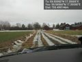
Then google told me to take a right, and the road got worse. And as it turned south it got really bad, you almost needed a tractor to use this "road". Found the farm that was closest to the hash and parked the car. I could see a lot of horse paddocks and I was hoping it was in a normal field and not a paddock. Couldn't see any people around to ask for permission, just some horses. I walked closer outside the paddocks and as I got really close there was one that was open so I walked inside. Found the hash pretty much smack in the middle of this paddock. Marked a tiny Orange™ marker as to not disturb too much and snapped some pics.

- Yet another horse paddock -- Carl-Johan @59.5595,17.3501 10:03, 25 February 2012 (CET)
I walked back towards the stables and there I met a woman named Anki who wondered who I was. I said I was from the internet and explained about geohashing. She couldn't really understand why anyone would do that but wished me, "Good Luck!". Ambassador after the fact.
Took a better road back towards the E18, not the crazy path only good for tractors and went and had some food at Max and bought a frying pan at Barkaby. Then off home.
Tracklog
map.
Photos
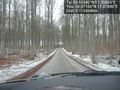
Trees @59.5716,17.3789
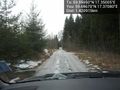
Road getting sketchy @59.5667,17.3708
Damn you Google Navigate! This isn't a road. @59.5656,17.3559
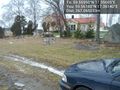
House for sale @59.5618,17.3514
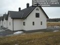
Stables @59.5618,17.3514
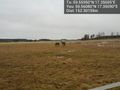
Horses @59.5608,17.3509
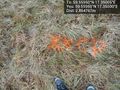
Tiny marker @59.5595,17.3500

Grin @59.5595,17.3500
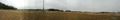
Panorama 1 @59.5596,17.3502
Panorama 2 @59.5596,17.3502


Achievements
Carl-Johan earned the Land geohash achievement
|
Carl-Johan earned the Ambassador achievement
|