Difference between revisions of "2012-02-29 59 9"
From Geohashing
imported>Relet ([live] Coordinates reached!) |
imported>Relet ([live picture] Stupid grin, and a headlight. [http://www.openstreetmap.org/?lat=59.72312053&lon=9.56444017&zoom=16&layers=B000FTF @59.7231,9.5644]) |
||
| Line 27: | Line 27: | ||
== Tracklog == | == Tracklog == | ||
| − | == Photos == | + | == Photos == |
| + | <gallery> | ||
| + | Image:2012-02-29_59_9_21-59-13-191.jpg | Stupid grin, and a headlight. [http://www.openstreetmap.org/?lat=59.72312053&lon=9.56444017&zoom=16&layers=B000FTF @59.7231,9.5644] | ||
| + | </gallery> | ||
| + | |||
{{#vardefine:gaWidth|250}} | {{#vardefine:gaWidth|250}} | ||
{{#vardefine:gaHeight|187}} | {{#vardefine:gaHeight|187}} | ||
Revision as of 20:59, 29 February 2012
| Wed 29 Feb 2012 in 59,9: 59.7230499, 9.5646499 geohashing.info google osm bing/os kml crox |
Location
In one of the mining areas near Kongsberg, Norway
Participants
- relet 05:43, 29 February 2012 (EST)
Plans
Hit the hash in the evening, leave in the morning.
Expedition
- In the bus to Oslo. It has come to this. -- relet @60.1664,10.2583 14:59, 29 februar 2012 (GMT+01:00)
- Step two: in the train to Kongsberg... -- relet @59.9109,10.7521 17:11, 29 februar 2012 (GMT+01:00)
- A small creek quickly turned into a non neglectable canyon. -- relet @59.7176,9.5631 20:56, 29 februar 2012 (GMT+01:00)
- Coordinates reached! -- relet @59.7231,9.5645 21:57, 29 februar 2012 (GMT+01:00)
Tracklog
Photos
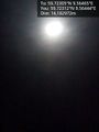
Stupid grin, and a headlight. @59.7231,9.5644

Achievements