Difference between revisions of "2012-03-01 50 11"
imported>Reinhard m |
imported>Reinhard (report) |
||
| Line 14: | Line 14: | ||
== Expedition == | == Expedition == | ||
| + | Temperatures clearly in the positive Celsius range and the need for some exercise made me heading out to this hashpoint which was a 33 km ride from Jena (one way). As usual it took me a while to get myself prepared and thus was close to 8 p.m. when I finally started the bicycle trip. All the roads were known, so the interesting part was whether I was fit enough for the ride after that winter, during which I almost wasn't cycling at all. From a shorter ride the weekend before I at least knew that everything after 40 km could feel very bad. Anyway, I had to try and getting to the hash area wasn't a serious problem. The hashpoint itself was in a dense forest and every map I looked at before at home didn't show a really close path leading there. I had chosen some paths for the intended track, but when I found a muddy path between two ponds leading in the direction I wanted to go, I took that one and quickly found out my road bike wasn't the perfect vehicle for this mission. Few meters later I pushed the bike over a muddy meadow and then was standing in front of the wood where only a small track was leading in ... if it was a track at all. It practically disappeared in the thicket some meters further and standing there with still 140 m to go, branches obscuring my sight and the typical slope you always have to climb to a hash I decided not to like the idea of being faced with the toughest 140 m of my life and just turned around letting the geohash be the meaningless thing it essentially is. No surprise, the way back got harder and harder and my thighs alternately felt like jelly or pinpricks, but I told them to act as they reliably acted the last years on much harder bike trips and tried to ignore their girlish behavior until I finally arrived Jena just before 11 p.m. | ||
Revision as of 14:09, 3 March 2012
| Thu 1 Mar 2012 in 50,11: 50.7474107, 11.7168382 geohashing.info google osm bing/os kml crox |
Location
In the forest near Neustadt an der Orla.
Participants
Expedition
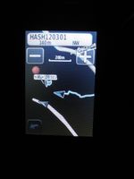
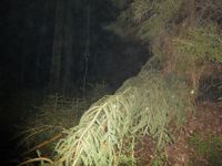
Temperatures clearly in the positive Celsius range and the need for some exercise made me heading out to this hashpoint which was a 33 km ride from Jena (one way). As usual it took me a while to get myself prepared and thus was close to 8 p.m. when I finally started the bicycle trip. All the roads were known, so the interesting part was whether I was fit enough for the ride after that winter, during which I almost wasn't cycling at all. From a shorter ride the weekend before I at least knew that everything after 40 km could feel very bad. Anyway, I had to try and getting to the hash area wasn't a serious problem. The hashpoint itself was in a dense forest and every map I looked at before at home didn't show a really close path leading there. I had chosen some paths for the intended track, but when I found a muddy path between two ponds leading in the direction I wanted to go, I took that one and quickly found out my road bike wasn't the perfect vehicle for this mission. Few meters later I pushed the bike over a muddy meadow and then was standing in front of the wood where only a small track was leading in ... if it was a track at all. It practically disappeared in the thicket some meters further and standing there with still 140 m to go, branches obscuring my sight and the typical slope you always have to climb to a hash I decided not to like the idea of being faced with the toughest 140 m of my life and just turned around letting the geohash be the meaningless thing it essentially is. No surprise, the way back got harder and harder and my thighs alternately felt like jelly or pinpricks, but I told them to act as they reliably acted the last years on much harder bike trips and tried to ignore their girlish behavior until I finally arrived Jena just before 11 p.m.
Photos
|

