Difference between revisions of "2012-03-08 44 -91"
imported>RocketMac |
imported>FippeBot m (Location) |
||
| (3 intermediate revisions by 3 users not shown) | |||
| Line 4: | Line 4: | ||
| date=2012-03-08 | | date=2012-03-08 | ||
}} | }} | ||
| − | |||
| − | |||
== Location == | == Location == | ||
| − | |||
The driveway of a farmhouse in Whitehall, Wisconsin. | The driveway of a farmhouse in Whitehall, Wisconsin. | ||
== Participants == | == Participants == | ||
| − | |||
* [[User:RocketMac|RocketMac]] | * [[User:RocketMac|RocketMac]] | ||
== Plans == | == Plans == | ||
| − | |||
I was going to be getting done with work and on the road home early, so I might be able to stop by this one geohash on the way. | I was going to be getting done with work and on the road home early, so I might be able to stop by this one geohash on the way. | ||
== Expedition == | == Expedition == | ||
| − | |||
| − | |||
Google Maps had a route for me that would have me off 94 until after the hashpoint, so I'd get to see some new roadway. When I left town, it was close to rush hour and I needed my turn-by-turn GPS app to get me out of the Twin Cities, and it wanted to use 94. I wasn't in a fighting mood, so I took it. | Google Maps had a route for me that would have me off 94 until after the hashpoint, so I'd get to see some new roadway. When I left town, it was close to rush hour and I needed my turn-by-turn GPS app to get me out of the Twin Cities, and it wanted to use 94. I wasn't in a fighting mood, so I took it. | ||
| Line 35: | Line 28: | ||
== Tracklog == | == Tracklog == | ||
| − | |||
My tracklog is available in [http://coldshadow.com/geohashing/2012-03-08.gpx GPX] and [http://coldshadow.com/geohashing/2012-03-08.kmz KMZ] formats. | My tracklog is available in [http://coldshadow.com/geohashing/2012-03-08.gpx GPX] and [http://coldshadow.com/geohashing/2012-03-08.kmz KMZ] formats. | ||
== Photos == | == Photos == | ||
| − | |||
| − | |||
| − | |||
<gallery perrow="5"> | <gallery perrow="5"> | ||
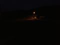
Image:2012-03-08 44 -91 01.jpg| The house | Image:2012-03-08 44 -91 01.jpg| The house | ||
| Line 50: | Line 39: | ||
== Achievements == | == Achievements == | ||
{{#vardefine:ribbonwidth|800px}} | {{#vardefine:ribbonwidth|800px}} | ||
| − | |||
{{land geohash | {{land geohash | ||
| latitude = 44 | | latitude = 44 | ||
| Line 58: | Line 46: | ||
| image = | | image = | ||
}} | }} | ||
| − | + | {{OpenStreetMap achievement | |
| − | + | | latitude = 44 | |
| − | + | | longitude = -91 | |
| − | + | | date = 2012-03-08 | |
| + | | OSMlink = http://www.openstreetmap.org/user/RocketMac/traces/1191974 | ||
| + | | OSMlink2 = | ||
| + | | OSMlink3 = | ||
| + | | name = RocketMac | ||
| + | | image = | ||
| + | }} | ||
[[Category:Expeditions]] | [[Category:Expeditions]] | ||
[[Category:Expeditions with photos]] | [[Category:Expeditions with photos]] | ||
[[Category:Coordinates reached]] | [[Category:Coordinates reached]] | ||
| + | {{location|US|WI|TR}} | ||
Latest revision as of 04:33, 6 August 2019
| Thu 8 Mar 2012 in 44,-91: 44.4130725, -91.3416416 geohashing.info google osm bing/os kml crox |
Location
The driveway of a farmhouse in Whitehall, Wisconsin.
Participants
Plans
I was going to be getting done with work and on the road home early, so I might be able to stop by this one geohash on the way.
Expedition
Google Maps had a route for me that would have me off 94 until after the hashpoint, so I'd get to see some new roadway. When I left town, it was close to rush hour and I needed my turn-by-turn GPS app to get me out of the Twin Cities, and it wanted to use 94. I wasn't in a fighting mood, so I took it.
It was just before sunset when I pulled off the freeway. ...Sadly it was still a heck of a drive to the hashpoint from there and getting dark.
By the time I reached the house it was dark. There were no signs of life inside and no lights, so I decided to take a chance and pull into the drive and up to the hashpoint. I get the feeling it's been a little while since someone had been here because the driveway was rough and muddy, but luckily still frozen. There was a point it got slick and I wasn't sure I wasn't going to get stuck. I dropped the car into second gear and drove slowly out.
There was another long drive back to he freeway and then I was heading on home.
I stopped for pizza and half a beer at Moosejaw Pizza and Brewhaus in the Wisconsin Dells. After that stop, it was a straight drive home.
Another new graticule!
Tracklog
My tracklog is available in GPX and KMZ formats.
Photos
The house
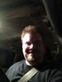
Stupid Grin
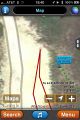
GPS Snapshot


Achievements
RocketMac earned the Land geohash achievement
|
RocketMac earned the OpenStreetMap achievement
|