Difference between revisions of "2012-03-19 53 -2"
imported>Angel |
imported>Angel m (→Photos: Damn typo) |
||
| Line 27: | Line 27: | ||
== Photos == | == Photos == | ||
<gallery perrow="5"> | <gallery perrow="5"> | ||
| − | Image:2012-03-19 53 -2 | + | Image:2012-03-19 53 -2 map.png | Hope those coords are right |
Image:2012-03-19 53 -2 photo.jpg | Is that the same car from the satellite view? | Image:2012-03-19 53 -2 photo.jpg | Is that the same car from the satellite view? | ||
</gallery> | </gallery> | ||
Revision as of 17:12, 19 March 2012

| Mon 19 Mar 2012 in 53,-2: 53.4556227, -2.7159722 geohashing.info google osm bing/os kml crox |
Location
From the google maps satellite photo, this appears to be on the pavement in Waine Street, St Helens. (Actually, if I click the "Google" link below the map it comes up in Eccleston. If I click the Google Maps link in Peeron it reports Waine Street)
Participants
Plans
Angel will walk from nearby Up Holland, going via Billinge. The shortest route is 7.5 miles, while this route is 8.2. However, the shorter route really isn't safe for pedestrians, so the extra mileage should bhe worth it. I'm expecting to arrive some time around 12, and maybe get lunch nearby, if anyone wants to join me.
Expedition
Only took 2 hours; that's pretty impressive. Took a little detour (the 'scenic route'), but otherwise followed the route I'd planned. Got a photo, then went off to KFC for lunch.
Tracklog
I'll download this once I get home
Photos
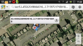
Hope those coords are right

Is that the same car from the satellite view?
