Difference between revisions of "2012-03-24 53 -2"
imported>Angel |
imported>Angel (→Photos) |
||
| Line 38: | Line 38: | ||
== Photos == | == Photos == | ||
| − | |||
| − | |||
<gallery perrow="5"> | <gallery perrow="5"> | ||
| − | Image:2012-03-24 53 -2 map.png | | + | Image:2012-03-24 53 -2 map.png | Screenshot of Geohash Droid; Angel's proof |
| + | Image:2012-03-24 53 -2 gps.jpg | Jonno's GPS | ||
| + | Image:2012-03-24 53 -2 Angel.jpg | Angel standing at the hash point | ||
| + | Image:2012-03-24 53 -2 Jonno.jpg | Jonno standing at the hash point | ||
| + | Image:2012-03-24 53 -2 view.jpg | The area where we expect to find a meetup | ||
</gallery> | </gallery> | ||
Revision as of 08:50, 25 March 2012
| Sat 24 Mar 2012 in 53,-2: 53.9558732, -2.7115310 geohashing.info google osm bing/os kml crox |
Location
Just inside the access area at Hayshaw Fell, just off Long Lane (somewhere south of Bay Horse)
Participants
Plans
Angel's plan: Walk down from Lancaster to Galgate, and then follow the road which seems to lead straight there. See whether or not the location is accessible; it looks like a field on satellite, but it might actually be within the Clougha Access Area. I'm hoping to hit the site some time before 4; if anyone else shows up, we'll retire to the pub in Bay Horse at 4:10.
Expedition
Expedition in progress; its 3pm now, and I suspect I'll be well late for the meetup. Met a friend on the way who's going by bike, though. So far, I had 3 stops for minor medical emergencies: Low blood sugar, nausea due to dehydration (necessitating a detour to grab more bottled water), and sudden diarrhea (maybe due to spicier-than-usual curry for lunch). I'm still heading there, but may be a bit late. -- Angel 11:08, 24 March 2012 (EDT)
Jonno made it to the point first; he was on the way back, and we met up again where the path meets the road at about 4:20. Then went back to the hash point, to collaborate on getting some photos of each other.
Tracklog
Will be uploaded when available
Photos
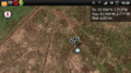
Screenshot of Geohash Droid; Angel's proof
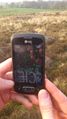
Jonno's GPS
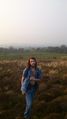
Angel standing at the hash point
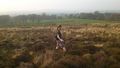
Jonno standing at the hash point
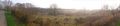
The area where we expect to find a meetup


