Difference between revisions of "2012-05-31 52 1"
imported>Sourcerer m (→Links) |
imported>Sourcerer m (→Expedition Photo) |
||
| Line 22: | Line 22: | ||
As I didn't reach the co-ordinates this is also not a Déjà vu geohash. | As I didn't reach the co-ordinates this is also not a Déjà vu geohash. | ||
| + | |||
| + | [[File:2012-05-31 52 1 Sourcerer.jpg]] | ||
{{Sourcerer_links | {{Sourcerer_links | ||
Revision as of 17:37, 3 July 2015
| Thu 31 May 2012 in Norwich: 52.5973369, 1.4389011 geohashing.info google osm bing/os kml crox |
Contents
Location
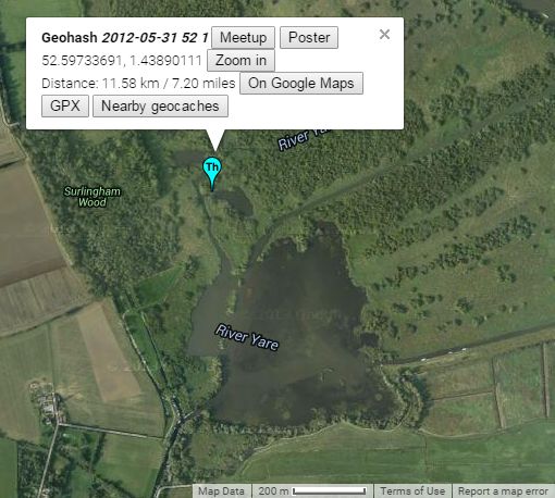
In a part of Surlingham Broad which can only be reached with a small boat at high tide.
Participants
Expedition
This is certainly a co-ordinates not reached as right now I lack the boat.
Way back in about 1973 during the summer, I sailed a wayfarer dinghy into this pool and stayed overnight beached on the mud when the tide was out. The boat had a canvas tent that could hang over the boom. The next morning the tide had come back in and I could sail away. This was one of the most private places I have ever camped out. Nice! I sailed from Beccles to Norwich and back on the rivers Waveney and Yare.
As I didn't reach the co-ordinates this is also not a Déjà vu geohash.
Expeditions and Plans
| 2012-05-31 | ||
|---|---|---|
| San Diego, California | Someone went | Not far from where I live so hopefully I'll be able to make it. -Mathgeek |
| Atlanta, Georgia | NWoodruff | 10 feet into the front yard of a house in Lawrenceville. |
| Schaumburg, Illinois | RocketMac | On private property on Northridge Trail in Hales Corners, WI. |
| Norwich, United Kingdom | Sourcerer | In a part of Surlingham Broad which can only be reached with a small boat a... |
Sourcerer's Expedition Links
2012-04-27 52 1 - 2012-05-31 52 1 - 2012-06-19 52 1 - KML file download of Sourcerer's expeditions for use with Google Earth.
