Difference between revisions of "2009-08-15 47 -122"
imported>Thomcat (Created page with "{{subst:Expedition |lat = 47 |lon = -122 |date = 2009-08-15 }}") |
imported>Thomcat (Document an expedition / meetup success from nearly 3 years ago) |
||
| Line 1: | Line 1: | ||
| − | |||
| − | |||
| − | |||
| − | |||
| − | |||
| − | |||
| − | |||
| − | |||
| − | |||
| − | |||
{{meetup graticule | {{meetup graticule | ||
| lat=47 | | lat=47 | ||
| Line 15: | Line 5: | ||
}} | }} | ||
| − | |||
__NOTOC__ | __NOTOC__ | ||
== Location == | == Location == | ||
| − | + | Just off the shore of Lake Washington | |
| − | == | + | == Retro Expedition == |
| − | + | On 2009-08-16, [[User:Thomcat|Thomcat]] was in the area and wanted to measure just how close to shore the previous day's Saturday geohash was, and also look to see if any markers were there. | |
| − | |||
| − | + | After measuring the geohash distance from the parking and the shore (closest was approximately 180 meters due west of the hash point), I then sat back to watch some Dragon boats - Seattle Club Sake. Looks like fun, will have to try that sometime. | |
| − | |||
| − | + | Just as I was getting ready to leave, two guys showed up with a camera and GPS - no, couldn't be. I went over and introduce myself to Jhon and Danny, two geohashers from Portland who were on their way through town and thought the same as me - let's see how close to shore this really is. | |
| − | |||
| − | + | To my knowledge, nobody went on Saturday, but I proclaim it a meetup success anyhow on Sunday! | |
| − | |||
== Photos == | == Photos == | ||
| − | |||
| − | |||
| − | |||
<gallery perrow="5"> | <gallery perrow="5"> | ||
| + | Image:2009-08-15_47_-122_Driving.jpg | ||
| + | Image:2009-08-15_47_-122_Parking.jpg | ||
| + | Image:2009-08-15_47_-122_Shore.jpg | From the shore, the closest we could get - 180 meters west | ||
| + | Image:2009-08-15_47_-122_Dragons.jpg | Any Dragon Boat geohashers? | ||
</gallery> | </gallery> | ||
| − | |||
| − | |||
| − | |||
| − | |||
| − | |||
| − | |||
| − | |||
| − | |||
| − | |||
| − | |||
| − | |||
| − | |||
| − | |||
| − | |||
| − | |||
[[Category:Expeditions]] | [[Category:Expeditions]] | ||
| − | |||
[[Category:Expeditions with photos]] | [[Category:Expeditions with photos]] | ||
| − | |||
| − | |||
| − | |||
| − | |||
| − | |||
| − | |||
| − | |||
| − | |||
| − | |||
[[Category:Coordinates not reached]] | [[Category:Coordinates not reached]] | ||
| − | + | [[Category:Not reached - Mother Nature]] | |
| − | [[Category:Not reached - Mother Nature]] | ||
| − | |||
| − | |||
| − | |||
| − | |||
Revision as of 14:50, 12 June 2012
| Sat 15 Aug 2009 in 47,-122: 47.5997355, -122.2830193 geohashing.info google osm bing/os kml crox |
Location
Just off the shore of Lake Washington
Retro Expedition
On 2009-08-16, Thomcat was in the area and wanted to measure just how close to shore the previous day's Saturday geohash was, and also look to see if any markers were there.
After measuring the geohash distance from the parking and the shore (closest was approximately 180 meters due west of the hash point), I then sat back to watch some Dragon boats - Seattle Club Sake. Looks like fun, will have to try that sometime.
Just as I was getting ready to leave, two guys showed up with a camera and GPS - no, couldn't be. I went over and introduce myself to Jhon and Danny, two geohashers from Portland who were on their way through town and thought the same as me - let's see how close to shore this really is.
To my knowledge, nobody went on Saturday, but I proclaim it a meetup success anyhow on Sunday!
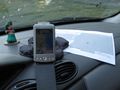
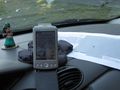
Photos
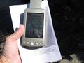
From the shore, the closest we could get - 180 meters west
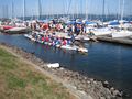
Any Dragon Boat geohashers?


