Difference between revisions of "2012-06-26 45 -122"
imported>Kydlt (→Tracklog) |
imported>Kydlt (→Photos) |
||
| Line 46: | Line 46: | ||
--> | --> | ||
<gallery perrow="5"> | <gallery perrow="5"> | ||
| + | image:2012-06-26 45 -122 AZ son & grandson.jpg|Not at the hash, but I still think that they are cute. | ||
| + | image:2012-06-26 45 -122 screenshot.jpg|Here is a photo of the track. I still haven't successfully uploaded a track file. | ||
| + | image:2012-06-26 45 -122 smiling dlt.jpg|Here i am holding the ipad with a location displayed. It is close, maybe within the limits of the GPS. | ||
| + | image:2012-06-26 45 -122 blurry streetsign.jpg|AZ son took a blurry photo of the nearest corner. | ||
</gallery> | </gallery> | ||
Revision as of 03:00, 27 June 2012
| Tue 26 Jun 2012 in 45,-122: 45.5135347, -122.4486076 geohashing.info google osm bing/os kml crox |
Location
Middle of a road in Gresham. On Burnside, strangely enough between the corners of Burnside & SE 209th and Burnside & SE 209th. Thank god for chicken lanes.
Participants
Plans
Pretty tempting, sitting in the middle of a road in Gresham....
Tempting enough, kydlt drove by & stopped in the middle of the street, with Kate, AZ son & AZ grandson. proof to follow.
Expedition
Kydlt, Kate, Erin (AZ son) & J.P. (AZ grandson) were coming home from a long weekend of great out of town fun. So I said, "Oh look, we can have more fun. Geohash fun. I don't think that they were impressed. But no one had to get out of the car. I didn't have my good GPS with me, but on the drive Kate programmed the hash location onto the ipad app 'GPS HD' by Motion X. We stopped in the chicken lane for a few while AZ son took a good photo of the ipad and a bad picture of the street sign. One calculator showed the displayed co-ords as being 3 1/2 off, another as being 27 feet off. Pretty close for not getting out.
Tracklog
Image:2012-06-16 45 -122 screenshot.jpg
Photos

Not at the hash, but I still think that they are cute.
- 2012-06-26 45 -122 screenshot.jpg
Here is a photo of the track. I still haven't successfully uploaded a track file.

Here i am holding the ipad with a location displayed. It is close, maybe within the limits of the GPS.
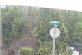
AZ son took a blurry photo of the nearest corner.


Achievements