Difference between revisions of "2012-07-16 50 11"
imported>Jens m |
imported>FippeBot m (Location) |
||
| (6 intermediate revisions by 2 users not shown) | |||
| Line 16: | Line 16: | ||
Today’s point might get the subject "3 things in one" as well, continue reading and you will learn why. | Today’s point might get the subject "3 things in one" as well, continue reading and you will learn why. | ||
| − | I skip the introduction, where I followed the Saale cycleway from Jena to Zeutsch, because there is nothing to say about it. Short before arriving in Zeutsch, I left the cycleway and usesd the path, leading to the forest. As the trees came near I spotted the way, I would have to use. 22% to climb. Not with me. I decided to park the bike just at the beginning of the forest. So I had to walk the last 1,5 km. It was not the worst decision. After the climb was done, the landscape changed from mountain to swamp. Mud puddles all on the way. They called themselves | + | I skip the introduction, where I followed the Saale cycleway from [http://www.everytrail.com/view_trip.php?trip_id=1674087&code=8525845de1f1a37f08ac997b07847c7e Jena to Zeutsch], because there is nothing to say about it. Short before arriving in Zeutsch, I left the cycleway and usesd the path, leading to the forest. As the trees came near I spotted the way, I would have to use. 22% to climb. Not with me. I decided to park the bike just at the beginning of the forest. So I had to walk the last 1,5 km. It was not the worst decision. After the climb was done, the landscape changed from mountain to swamp. Mud puddles all on the way. They called themselves "nature trail", as it was written on the signs everywhere, but I call them mud puddles. So after all these obstructions were passed, I finally arrived at the hashpoint. And, surprise surprise, it was 1 meter beside the path. So the rest was done quickly. I took the photo with the coordinates and another one with the Räbe, and I forgot the stupid grin (again). |
| − | Now let’s get to station 2. I went back the nature trail (the mud puddle path, you know), but then turned left and after some meters of climbing up again I was at the church ruin of Töpfersdorf (never before heard about it, but doesn’t matter). Here I added some cultural history to the tour and, next surprise, a geocache that inhabits the ruin. For all | + | Now let’s get to station 2. I went back the nature trail (the mud puddle path, you know), but then turned left and after some meters of climbing up again I was at the church ruin of Töpfersdorf (never before heard about it, but doesn’t matter). Here I added some cultural history to the tour and, next surprise, a [http://www.geocaching.com/seek/cache_details.aspx?guid=b5701166-4688-41a9-844d-8c105ad1b14f geocache] that inhabits the ruin. For all who do not know, geocaches are the sisters and brothers of hashpoints. A box filled with trash, hidden in the middle of nowhere and you have to find them. |
| − | After some additional photos were taken, I went to the last station. More culture and more geocache. This time the culture consists of a rock with a sign on it, that explains, how important the rock is. Photos are taken, let’s get home. There waits a cake to be eaten in pleasant company. | + | After some additional photos were taken, I went to the last station. More culture and more [http://www.geocaching.com/seek/cache_details.aspx?guid=ee472869-3a03-4949-be88-c96ddfbfbdfc geocache]. This time the culture consists of a rock with a sign on it, that explains, how important the rock is. Photos are taken, let’s get home. There waits a cake to be eaten in pleasant company. |
| + | == Photos == | ||
| + | {{gallery|width=200|height=200|lines=2 | ||
| + | |Image:120716 50 11 01.jpg|The Saale beside the cycleway. | ||
| + | |Image:120716 50 11 02.jpg|Mud puddle. | ||
| + | |Image:120716 50 11 03.jpg|The mud puddle path calls itself "nature trail". | ||
| + | |Image:120716 50 11 04.jpg|Coordinates reached. | ||
| + | |Image:120716 50 11 05.jpg|The Hashpoint. | ||
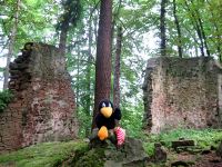
| + | |Image:120716 50 11 06.jpg|Church ruin. | ||
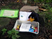
| + | |Image:120716 50 11 07.jpg|Cache 1. | ||
| + | |Image:120716 50 11 08.jpg|Important rock (note the sign). | ||
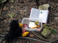
| + | |Image:120716 50 11 09.jpg|Cache 2. | ||
| + | }} | ||
[[Category:Expeditions]] | [[Category:Expeditions]] | ||
[[Category:Expeditions with photos]] | [[Category:Expeditions with photos]] | ||
[[Category:Coordinates reached]] | [[Category:Coordinates reached]] | ||
| + | {{location|DE|TH|SLF}} | ||
Latest revision as of 05:05, 13 August 2019
| Mon 16 Jul 2012 in 50,11: 50.7328832, 11.5090901 geohashing.info google osm bing/os kml crox |
Location
Forest near Zeutsch
Participants
- Jens and Räbe
Expedition
Today’s point might get the subject "3 things in one" as well, continue reading and you will learn why.
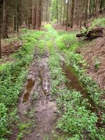
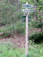
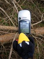
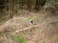
I skip the introduction, where I followed the Saale cycleway from Jena to Zeutsch, because there is nothing to say about it. Short before arriving in Zeutsch, I left the cycleway and usesd the path, leading to the forest. As the trees came near I spotted the way, I would have to use. 22% to climb. Not with me. I decided to park the bike just at the beginning of the forest. So I had to walk the last 1,5 km. It was not the worst decision. After the climb was done, the landscape changed from mountain to swamp. Mud puddles all on the way. They called themselves "nature trail", as it was written on the signs everywhere, but I call them mud puddles. So after all these obstructions were passed, I finally arrived at the hashpoint. And, surprise surprise, it was 1 meter beside the path. So the rest was done quickly. I took the photo with the coordinates and another one with the Räbe, and I forgot the stupid grin (again).
Now let’s get to station 2. I went back the nature trail (the mud puddle path, you know), but then turned left and after some meters of climbing up again I was at the church ruin of Töpfersdorf (never before heard about it, but doesn’t matter). Here I added some cultural history to the tour and, next surprise, a geocache that inhabits the ruin. For all who do not know, geocaches are the sisters and brothers of hashpoints. A box filled with trash, hidden in the middle of nowhere and you have to find them.
After some additional photos were taken, I went to the last station. More culture and more geocache. This time the culture consists of a rock with a sign on it, that explains, how important the rock is. Photos are taken, let’s get home. There waits a cake to be eaten in pleasant company.
Photos
|

