Difference between revisions of "2012-08-19 28 -82"
imported>Farretpotter (Created page with "f you did not specify these parameters in the template, please substitute appropriate values for IMAGE, LAT, LON, and DATE (YYYY-MM-DD format) And DON'T FORGET to add your exp...") |
imported>Farretpotter |
||
| Line 1: | Line 1: | ||
| − | |||
| − | |||
| − | |||
| − | |||
--> | --> | ||
{{meetup graticule | {{meetup graticule | ||
Revision as of 16:57, 19 August 2012
-->
| Sun 19 Aug 2012 in 28,-82: 28.2624920, -82.0300963 geohashing.info google osm bing/os kml crox |
Location
In a stand of trees in the middle of a pasture out on the edge of Colt Creek Park.
Participants
- Farretpotter
- Various family members
Plans
No real plans. Saw the hash for today was off what looked like a ranch road in what might be a dry area. Good enough for a first go.
Expedition
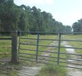
We left home at about 9:00, drove to what looked on satellite like the nearest ranch road access to the hash. Got there, discovered a fully locked gate with warning signs. Undeterred, we drove up a bit further to the proper Colt Creek park entrance. Had to pay the four bucks to get in, and then violate another "no public access" sign (this with open, unlocked gate) to find the other end of that closed-off ranch road. Spooked a family of wild boars on the way in -- mom and as many as four kind of biggish youngsters. They were too fast to get a picture, sadly.
We took the ranch road in as far as seemed reasonable (actually a little further, but careful piloting got us turned around in the muck and out without getting stuck). Hiked out through the pasture to the stand of trees where the hash was located. Pasture was dry, but my little brother didn't like the tall grass and quit to wait for us about 100m from the hash.
It turned out, the stand of trees was actually a stand of cypress plunked in an unknown number of feet of dark bog water. We didn't come dressed for that... Still, the has was close enough to the edge trees, we were able to hop on grass clumps and tree roots and get to within close enough that I'm going to call this one "achieved".
Then hiking out, lunch on the way home. A very good first hash.
Tracklog
Photos
Farretpotter just happy to be here
Achievements
Farretpotter earned the Land geohash achievement
|
Farretpotter earned the Admit One Achievement
|
Farretpotter earned the Police Geohash Achievement
|


