Difference between revisions of "2012-09-08 55 37"
From Geohashing
imported>Vb ([live picture] [http://www.openstreetmap.org/?lat=55.80802155&lon=37.55993713&zoom=16&layers=B000FTF @55.8080,37.5599]) |
imported>FippeBot m (Location) |
||
| (14 intermediate revisions by 2 users not shown) | |||
| Line 1: | Line 1: | ||
| − | |||
| − | |||
| − | |||
| − | |||
| − | |||
| − | |||
| − | |||
| − | |||
| − | |||
{{meetup graticule | {{meetup graticule | ||
| lat=55 | | lat=55 | ||
| Line 33: | Line 24: | ||
== Expedition == | == Expedition == | ||
<!-- how it all turned out. your narrative goes here. --> | <!-- how it all turned out. your narrative goes here. --> | ||
| − | + | Failed to find the entrance to the botanical garden part of the park. | |
== Tracklog == | == Tracklog == | ||
| Line 45: | Line 36: | ||
| − | Image:2012-09-08_55_37_16-25-37-313.jpg | [http://www.openstreetmap.org/?lat=55.80799321&lon=37.55998426&zoom=16&layers=B000FTF @55.8080,37.5600] | + | Image:2012-09-08_55_37_16-25-37-313.jpg | The hash (approximately). [http://www.openstreetmap.org/?lat=55.80799321&lon=37.55998426&zoom=16&layers=B000FTF @55.8080,37.5600] |
| + | |||
| + | Image:2012-09-08_55_37_16-26-21-401.jpg | The hash (approximately). W [http://www.openstreetmap.org/?lat=55.80802155&lon=37.55993713&zoom=16&layers=B000FTF @55.8080,37.5599] | ||
| + | |||
| + | Image:2012-09-08_55_37_16-27-06-832.jpg | The hash (approximately). D [http://www.openstreetmap.org/?lat=55.80791947&lon=37.55999316&zoom=16&layers=B000FTF @55.8079,37.5600] | ||
| + | |||
| + | Image:2012-09-08_55_37_16-27-41-196.jpg | The hash (approximately). A [http://www.openstreetmap.org/?lat=55.80791719&lon=37.56003311&zoom=16&layers=B000FTF @55.8079,37.5600] | ||
| + | |||
| + | Image:2012-09-08_55_37_16-28-28-455.jpg | The hash (approximately). S [http://www.openstreetmap.org/?lat=55.80798310&lon=37.56003929&zoom=16&layers=B000FTF @55.8080,37.5600] | ||
| + | |||
| + | Image:2012-09-08_55_37_16-29-01-235.jpg | The sky above the hash (approximately). [http://www.openstreetmap.org/?lat=55.80801112&lon=37.56006152&zoom=16&layers=B000FTF @55.8080,37.5601] | ||
| + | |||
| + | Image:2012-09-08_55_37_16-48-59-502.jpg | "Blogers against trash" [http://www.openstreetmap.org/?lat=55.80836839&lon=37.55600226&zoom=16&layers=B000FTF @55.8084,37.5560] | ||
| + | |||
| + | Image:2012-09-08_55_37_16-49-49-871.jpg | [http://www.openstreetmap.org/?lat=55.80838402&lon=37.55597637&zoom=16&layers=B000FTF @55.8084,37.5560] | ||
| + | |||
| + | Image:2012-09-08_55_37_17-53-15-087.jpg | [http://www.openstreetmap.org/?lat=55.82678836&lon=37.54570786&zoom=16&layers=B000FTF @55.8268,37.5457] | ||
| + | |||
| + | Image:2012-09-08_55_37_17-53-48-417.jpg | [http://www.openstreetmap.org/?lat=55.82675523&lon=37.54560042&zoom=16&layers=B000FTF @55.8268,37.5456] | ||
| − | Image:2012-09- | + | Image:2012-09-08_55_37_17-54-22-835.jpg | "Like a brush in hands of an artist, we have no idea where are we" [http://www.openstreetmap.org/?lat=55.82670806&lon=37.54559932&zoom=16&layers=B000FTF @55.8267,37.5456] |
</gallery> | </gallery> | ||
| Line 55: | Line 64: | ||
| − | |||
| − | |||
| − | |||
| − | |||
| − | |||
| − | |||
| − | |||
| − | |||
| − | |||
| − | |||
[[Category:Expeditions]] | [[Category:Expeditions]] | ||
| − | |||
[[Category:Expeditions with photos]] | [[Category:Expeditions with photos]] | ||
| − | |||
| − | |||
| − | |||
| − | |||
| − | |||
[[Category:Coordinates reached]] | [[Category:Coordinates reached]] | ||
| − | + | [[Category:Public transport geohash achievement]] | |
| − | + | {{location|RU|MOW}} | |
| − | |||
| − | [[Category: | ||
| − | |||
| − | |||
| − | |||
| − | |||
| − | |||
| − | |||
| − | |||
| − | |||
| − | |||
| − | |||
| − | |||
| − | |||
| − | |||
| − | |||
Latest revision as of 06:00, 13 August 2019
| Sat 8 Sep 2012 in 55,37: 55.8080342, 37.5599756 geohashing.info google osm bing/os kml crox |
Location
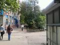
A sidewalk in residential area in Timiryazevsky District of Moscow.
Nearest subway station is Dmitrovskaya.
Participants
Plans
Visit the place, then go for a walk in neighbouring garden/park of Russian State Agricultural University.
Expedition
Failed to find the entrance to the botanical garden part of the park.
Tracklog
Photos
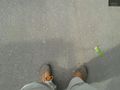
The hash (approximately). @55.8080,37.5600
The hash (approximately). W @55.8080,37.5599
The hash (approximately). D @55.8079,37.5600
The hash (approximately). A @55.8079,37.5600
The hash (approximately). S @55.8080,37.5600
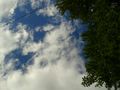
The sky above the hash (approximately). @55.8080,37.5601
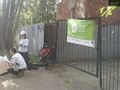
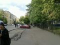
"Blogers against trash" @55.8084,37.5560
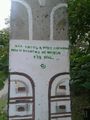
"Like a brush in hands of an artist, we have no idea where are we" @55.8267,37.5456


