Difference between revisions of "2012-09-19 50 11"
imported>Jens (→Expedition) |
imported>Jens |
||
| Line 17: | Line 17: | ||
Compared to other points I’ve been to, even the last meters were easy. The point was located in a field, 20 meters away from the dirt road. The field was dry, no mud began sticking on the shoes, when taking the point’s photos. Since everything was that easy, I decided to save even more CO2 on my way home by taking a little detour via Bucha. | Compared to other points I’ve been to, even the last meters were easy. The point was located in a field, 20 meters away from the dirt road. The field was dry, no mud began sticking on the shoes, when taking the point’s photos. Since everything was that easy, I decided to save even more CO2 on my way home by taking a little detour via Bucha. | ||
| + | |||
| + | |||
| + | == Photos == | ||
| + | {{gallery|width=200|height=200|lines=2 | ||
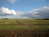
| + | |Image:120919 50 11 01.jpg|View to the point. | ||
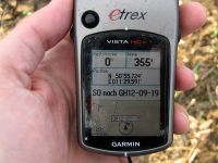
| + | |Image:120919 50 11 02.jpg|Coordinates reached. | ||
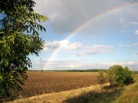
| + | |Image:120919 50 11 03.jpg|A Rainbow ... | ||
| + | |Image:120919 50 11 04.jpg|... watched by Räbe. | ||
| + | |Image:120919 50 11 05.jpg|The way back home. | ||
| + | }} | ||
[[Category:Expeditions]] | [[Category:Expeditions]] | ||
[[Category:Expeditions with photos]] | [[Category:Expeditions with photos]] | ||
[[Category:Coordinates reached]] | [[Category:Coordinates reached]] | ||
Revision as of 19:37, 19 September 2012
| Wed 19 Sep 2012 in 50,11: 50.9287221, 11.4931807 geohashing.info google osm bing/os kml crox |
Location
On a field near Großschwabhausen
Participants
- Jens and Räbe
Expedition
Today’s point was to close to miss. The area it lay on was well known to me, so there was no need for long preparations. Just loading the point to the PGS device, sitting on the bike, pedaling some minutes and there it was. And even better, the 8 km I had to go, can just be reused for a campaign that takes place in these weeks. It’s about saving CO2 by going by bike (probably compared to going by car). So thanks to today’s point, you saved CO2 for 8 km.
Compared to other points I’ve been to, even the last meters were easy. The point was located in a field, 20 meters away from the dirt road. The field was dry, no mud began sticking on the shoes, when taking the point’s photos. Since everything was that easy, I decided to save even more CO2 on my way home by taking a little detour via Bucha.
Photos
|


