Difference between revisions of "2012-10-06 50 11"
From Geohashing
imported>Jens m (→Expedition) |
imported>FippeBot m (Location) |
||
| (One intermediate revision by one other user not shown) | |||
| Line 19: | Line 19: | ||
== Photos == | == Photos == | ||
| + | {{gallery|width=200|height=200|lines=2 | ||
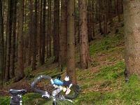
| + | |Image:121006 50 11 01.jpg|The bike and the hill. | ||
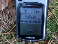
| + | |Image:121006 50 11 02.jpg|Coordinates reached. | ||
| + | |Image:121006 50 11 03.jpg|Räbe performing the stupid grin. | ||
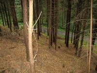
| + | |Image:121006 50 11 04.jpg|View down from the point. | ||
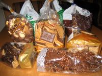
| + | |Image:121006 50 11 05.jpg|Additional ballast for the way home. | ||
| + | }} | ||
[[Category:Expeditions]] | [[Category:Expeditions]] | ||
[[Category:Expeditions with photos]] | [[Category:Expeditions with photos]] | ||
[[Category:Coordinates reached]] | [[Category:Coordinates reached]] | ||
| + | {{location|DE|TH|SHK}} | ||
Latest revision as of 06:25, 13 August 2019
| Sat 6 Oct 2012 in 50,11: 50.8559654, 11.7559718 geohashing.info google osm bing/os kml crox |
Location
In a forest near Stadtroda
Participants
- Jens and Räbe
Expedition
Last chance to save some CO2, the point looked fine, the weather too. So I cycled to Stadtroda where I entered the dirt road through the wood, that led 20 meters beside the point. And of course the point was not only 20 meters beside the path, but also 10 meters above it. So I climbed up the hill. There were some trees (why not, it’s a forest we are in) but no thicket, no brushwood, so it was okay.
After taking some pictures at the point, I continued cycling to the next station, the cookie factory near Kahla. Here I added some ballast to the bike, … ehm … to be honest as much as the bag was able to take in.
Photos
|


