Difference between revisions of "2012-10-15 60 22"
imported>Suurnesu ([live] Test) |
imported>FippeBot m (Location) |
||
| (8 intermediate revisions by 4 users not shown) | |||
| Line 1: | Line 1: | ||
| − | |||
| − | |||
| − | |||
| − | |||
| − | |||
| − | |||
| − | |||
| − | |||
| − | |||
| − | |||
{{meetup graticule | {{meetup graticule | ||
| lat=60 | | lat=60 | ||
| Line 19: | Line 9: | ||
== Location == | == Location == | ||
<!-- where you've surveyed the hash to be --> | <!-- where you've surveyed the hash to be --> | ||
| + | Hashpoint ended up in an easily accesible cycleway some kilometers west from Turku city centre, in Perno suburb. | ||
== Participants == | == Participants == | ||
<!-- who attended: If you link to your wiki user name in this section, your expedition will be picked up by the various statistics generated for geohashing. You may use three tildes ~ as a shortcut to automatically insert the user signature of the account you are editing with. | <!-- who attended: If you link to your wiki user name in this section, your expedition will be picked up by the various statistics generated for geohashing. You may use three tildes ~ as a shortcut to automatically insert the user signature of the account you are editing with. | ||
--> | --> | ||
| + | *[[User:Suurnesu|suurnesu]] | ||
| + | *[[User:nsk|nsk]] | ||
== Plans == | == Plans == | ||
| Line 30: | Line 23: | ||
<!-- how it all turned out. your narrative goes here. --> | <!-- how it all turned out. your narrative goes here. --> | ||
| + | It was a cold rainy evening, too ugly weather for a geocache. Fortunately, today's hashpoint was very conveniently located close to a Siwa's parking lot. So, I drove some 5 kilometers to the place. This time I used Android's geohashing application. It seemed to work just perfectly and even uploaded the pictures. Saves a lot of time since I am not very good in editing these pages :) | ||
| + | |||
| + | Nothing special really about his geohash, ugly weather and ugly neighbourhood... Still, it gave me a reason to go out. Oh yes, I also bought a bottle of Jaffa from nearby Siwa. Boy, was that refreshing! | ||
| + | |||
| + | - Suurnesu | ||
| + | |||
| + | ------------------------------ | ||
| + | |||
| + | It was a very rainy evening but I still decided to do a little evening cycling here. It was raining all the time while I cycled there and it was raining heavily so I were quite throughly wet when I reached the geohash after 8,3 kilometers of cycling. Luckily hash wasn't in deep woods or somewhere else that could require some hiking, it was an easily accessed location right on the pathway. So I could take the "required" photo while sitting on my bike. :) Location wasn't anything special, Perno is just a common suburb of Turku, nothing fancy or neat views to see. But a good reason to get out anyway! | ||
| + | |||
| + | - nsk | ||
| − | |||
== Tracklog == | == Tracklog == | ||
<!-- if your GPS device keeps a log, you may post a link here --> | <!-- if your GPS device keeps a log, you may post a link here --> | ||
| Line 42: | Line 45: | ||
Image:2012-10-15_60_22_20-38-40-754.jpg | In Perno [http://www.openstreetmap.org/?lat=60.45390000&lon=22.15640000&zoom=16&layers=B000FTF @60.4539,22.1564] | Image:2012-10-15_60_22_20-38-40-754.jpg | In Perno [http://www.openstreetmap.org/?lat=60.45390000&lon=22.15640000&zoom=16&layers=B000FTF @60.4539,22.1564] | ||
| + | Image:2012-10-15_60_22_21-25-23-019.jpg | Rainy street | ||
| + | File:2012-10-15_60_22_nsks_gpsr_and_todays_coords.jpg|nsk's GPSr and today's coords | ||
</gallery> | </gallery> | ||
| Line 49: | Line 54: | ||
| − | |||
| − | |||
| − | |||
| − | |||
| − | |||
| − | |||
| − | |||
| − | |||
| − | |||
| − | |||
[[Category:Expeditions]] | [[Category:Expeditions]] | ||
| − | |||
[[Category:Expeditions with photos]] | [[Category:Expeditions with photos]] | ||
| − | |||
| − | |||
| − | |||
| − | |||
| − | |||
[[Category:Coordinates reached]] | [[Category:Coordinates reached]] | ||
| − | + | {{location|FI|19}} | |
| − | |||
| − | |||
| − | |||
| − | |||
| − | |||
| − | |||
| − | |||
| − | |||
| − | |||
| − | |||
| − | |||
| − | |||
| − | |||
| − | |||
| − | |||
| − | |||
| − | |||
Latest revision as of 06:32, 13 August 2019
| Mon 15 Oct 2012 in 60,22: 60.4538044, 22.1561817 geohashing.info google osm bing/os kml crox |
Location
Hashpoint ended up in an easily accesible cycleway some kilometers west from Turku city centre, in Perno suburb.
Participants
Plans
Expedition
It was a cold rainy evening, too ugly weather for a geocache. Fortunately, today's hashpoint was very conveniently located close to a Siwa's parking lot. So, I drove some 5 kilometers to the place. This time I used Android's geohashing application. It seemed to work just perfectly and even uploaded the pictures. Saves a lot of time since I am not very good in editing these pages :)
Nothing special really about his geohash, ugly weather and ugly neighbourhood... Still, it gave me a reason to go out. Oh yes, I also bought a bottle of Jaffa from nearby Siwa. Boy, was that refreshing!
- Suurnesu
It was a very rainy evening but I still decided to do a little evening cycling here. It was raining all the time while I cycled there and it was raining heavily so I were quite throughly wet when I reached the geohash after 8,3 kilometers of cycling. Luckily hash wasn't in deep woods or somewhere else that could require some hiking, it was an easily accessed location right on the pathway. So I could take the "required" photo while sitting on my bike. :) Location wasn't anything special, Perno is just a common suburb of Turku, nothing fancy or neat views to see. But a good reason to get out anyway!
- nsk
Tracklog
Photos

In Perno @60.4539,22.1564
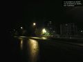
Rainy street
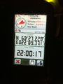
nsk's GPSr and today's coords


