Difference between revisions of "2012-11-01 32 34"
imported>LiNaK |
imported>LiNaK |
||
| Line 44: | Line 44: | ||
Image:2012-11-01_32_34_stream.jpg|Crossing the stream (actually more of an open sewage) | Image:2012-11-01_32_34_stream.jpg|Crossing the stream (actually more of an open sewage) | ||
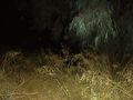
Image:2012-11-01_32_34_stream2.jpg|Local nature | Image:2012-11-01_32_34_stream2.jpg|Local nature | ||
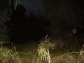
| − | Image:2012-11-01_32_34_later.jpg|We'll return here later | + | Image:2012-11-01_32_34_later.jpg|We'll return here later. |
Image:2012-11-01_32_34_field.jpg|Field | Image:2012-11-01_32_34_field.jpg|Field | ||
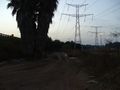
Image:2012-11-01_32_34_factory.jpg|Frozen food factory | Image:2012-11-01_32_34_factory.jpg|Frozen food factory | ||
| Line 52: | Line 52: | ||
Image:2012-11-01_32_34_breakthrough.jpg|We have a breakthrough! | Image:2012-11-01_32_34_breakthrough.jpg|We have a breakthrough! | ||
Image:2012-11-01_32_34_way.jpg|The way we were looking for | Image:2012-11-01_32_34_way.jpg|The way we were looking for | ||
| − | Image:2012-11-01_32_34_way2.jpg|At last, I have a direction I can be sure of | + | Image:2012-11-01_32_34_way2.jpg|At last, I have a direction I can be sure of. |
Image:2012-11-01_32_34_israel.jpg|Israel Trail marking- white,blue and yellow (it wasn't actually that dark- yet) | Image:2012-11-01_32_34_israel.jpg|Israel Trail marking- white,blue and yellow (it wasn't actually that dark- yet) | ||
| − | Image:2012-11-01_32_34_orchard.jpg|I was nearly tempted to take one, but they were probably not ripe anyway | + | Image:2012-11-01_32_34_orchard.jpg|I was nearly tempted to take one, but they were probably not ripe anyway. |
| − | Image:2012-11-01_32_34_river.jpg|The Yarkon is right after these plants, in the darkness | + | Image:2012-11-01_32_34_river.jpg|The Yarkon is right after these plants, in the darkness. |
Image:2012-11-01_32_34_river2.jpg|The hashpoint should be around here. Anyway, close enough for success. | Image:2012-11-01_32_34_river2.jpg|The hashpoint should be around here. Anyway, close enough for success. | ||
</gallery> | </gallery> | ||
Revision as of 20:35, 2 November 2012
| Thu 1 Nov 2012 in 32,34: 32.1261788, 34.9103960 geohashing.info google osm bing/os kml crox |
Location
Besides Yarkon River, between Petah Tikva and Neve Ne'eman
Participants
Omri (LinaK)
Tal
Plans
The plan is to go after school, with Lilac and probably Tal if he'll want to join us. We'll take line 67 to the central bus station in Petah Tikva and than walk, first along HaYarkonim Way or through the industrial district and after passing the train station we'll join the cross-Israel walking trail until we'll get to the hashpoint, just next to the river itself. It should all take only a few hours as Lilac said she'll have to arrive at Tel Aviv by six.
Expedition
TBD tomorrow
Photos
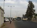
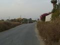
Petah Tikva central bus station
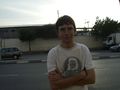
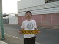
Tal is unimpressed with my preparation for today.
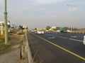
Kids, don't walk next to the main road.
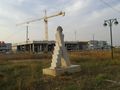
Statue on an unfinished promenade
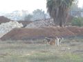
We've found some dogs along the way!
Tal found his way to pass the time on the long walk...
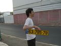
Uhm...yes...
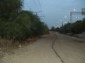
Crossing the stream (actually more of an open sewage)
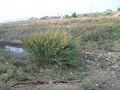
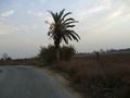
Local nature
We'll return here later.
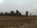
Field
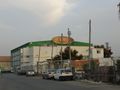
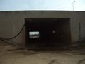
Frozen food factory
Wrong way
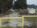
At the Baptist village
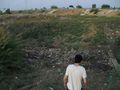
Walking by my own
We have a breakthrough!
The way we were looking for
At last, I have a direction I can be sure of.
Israel Trail marking- white,blue and yellow (it wasn't actually that dark- yet)
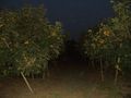
I was nearly tempted to take one, but they were probably not ripe anyway.
The Yarkon is right after these plants, in the darkness.
The hashpoint should be around here. Anyway, close enough for success.


Achievements