Difference between revisions of "2013-01-19 60 22"
From Geohashing
imported>Pehku (→Photos) |
imported>Calamus (Categorizing) |
||
| Line 1: | Line 1: | ||
| − | |||
<!-- If you did not specify these parameters in the template, please substitute appropriate values for IMAGE, LAT, LON, and DATE (YYYY-MM-DD format) | <!-- If you did not specify these parameters in the template, please substitute appropriate values for IMAGE, LAT, LON, and DATE (YYYY-MM-DD format) | ||
| Line 18: | Line 17: | ||
__NOTOC__ | __NOTOC__ | ||
== Location == | == Location == | ||
| − | + | An a field near Piikiö. | |
== Participants == | == Participants == | ||
| − | + | [[User:Pehku|Pehku]] | |
| − | |||
== Plans == | == Plans == | ||
| Line 48: | Line 46: | ||
== Achievements == | == Achievements == | ||
{{#vardefine:ribbonwidth|800px}} | {{#vardefine:ribbonwidth|800px}} | ||
| − | + | {{Land geohash|latitude=60|longitude=22|date=2013-01-19|name=[[User:Pehku|Pehku]]}} | |
| + | {{Frozen Geohash|latitude=60|longitude=22|date=2013-01-19|temperature=about -10°C|name=[[User:Pehku|Pehku]]}} | ||
| − | |||
| − | |||
| − | |||
| − | |||
| − | |||
| − | |||
| − | |||
| − | |||
| − | |||
| − | |||
[[Category:Expeditions]] | [[Category:Expeditions]] | ||
| − | + | [[Category:Expeditions with photos]] | |
| − | [[Category:Expeditions with photos]] | ||
| − | |||
| − | |||
| − | |||
| − | |||
| − | |||
[[Category:Coordinates reached]] | [[Category:Coordinates reached]] | ||
| − | |||
| − | |||
| − | |||
| − | |||
| − | |||
| − | |||
| − | |||
| − | |||
| − | |||
| − | |||
| − | |||
| − | |||
| − | |||
| − | |||
| − | |||
| − | |||
| − | |||
| − | |||
Revision as of 16:03, 19 January 2013
| Sat 19 Jan 2013 in 60,22: 60.4105615, 22.5437263 geohashing.info google osm bing/os kml crox |
Location
An a field near Piikiö.
Participants
Plans
Expedition
- My first geohash! -- Pehku @60.4106,22.5438 08:00, 19 January 2013 (EST)
Tracklog
Photos
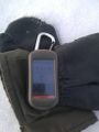
At the Zero


Achievements
Pehku earned the Land geohash achievement
|
Pehku earned the Frozen Geohash Achievement
|