Difference between revisions of "2013-03-01 48 9"
From Geohashing
imported>Steingesicht |
imported>FippeBot m (Location) |
||
| (One intermediate revision by one other user not shown) | |||
| Line 5: | Line 5: | ||
[[User:Steingesicht|Steingesicht]] | [[User:Steingesicht|Steingesicht]] | ||
== Plans == | == Plans == | ||
| − | [[User:Steingesicht|Steingesicht]] | + | [[User:Steingesicht|Steingesicht]] planned to go after work |
| + | |||
== Expedition == | == Expedition == | ||
I started after work an went by car to Neckarhausen. The last km to the hash-point I went by feet. There is a nice view to the Neckar river from the way, but not today - to much the weather was a little misty- | I started after work an went by car to Neckarhausen. The last km to the hash-point I went by feet. There is a nice view to the Neckar river from the way, but not today - to much the weather was a little misty- | ||
| Line 28: | Line 29: | ||
[[Category:Coordinates reached]] | [[Category:Coordinates reached]] | ||
[[Category:Expeditions_with_marker]] | [[Category:Expeditions_with_marker]] | ||
| + | {{location|DE|BW|ES}} | ||
Latest revision as of 01:11, 14 August 2019
| Fri 1 Mar 2013 in 48,9: 48.6200128, 9.2956441 geohashing.info google osm bing/os kml crox |
Location
An orchard near Neckarhausen (Nürtingen)
Participants
Plans
Steingesicht planned to go after work
Expedition
I started after work an went by car to Neckarhausen. The last km to the hash-point I went by feet. There is a nice view to the Neckar river from the way, but not today - to much the weather was a little misty- The track through the orchard was wet and muddy because of the melting snow. I reached the hashpoint, took some photos and left the sign at an nearby bench.
Photos
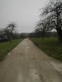
The way to the hash-point was a little muddy
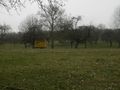
contractor's shed at the way

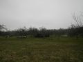
the bench not far from the point - a good place for the sign

the sign

mark at hashpoint

hashproof

view to the east

view to the south

view to the west
view to the north


